Eichstätt elevation
Eichstätt (Bavaria, Upper Bavaria), Germany elevation is 397 meters and Eichstätt elevation in feet is 1302 ft above sea level [src 1]. Eichstätt is a seat of a third-order administrative division (feature code) with elevation that is 139 meters (456 ft) bigger than average city elevation in Germany.
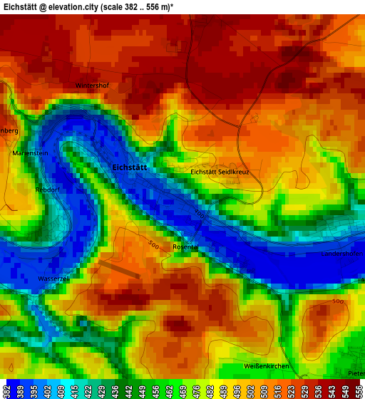
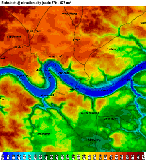
Below is the Elevation map of Eichstätt, which displays elevation range with different colors. Scale of the first map is from 382 to 556 m (1253 to 1824 ft) with average elevation of 481.2 meters (=1579 ft) [note 1]
These maps also provides idea of topography and contour of this city, they are displayed at different zoom levels. More info about maps, scale and edge coordinates you can find below images.
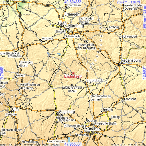
| \ | Map #1 | Map #2 | Topo.Map |
| Scale [m] | 382..556 m | 379..577 m | × |
| Scale [ft] | 1253..1824 ft | 1243..1893 ft | × |
| Average | 481.2 m = 1579 ft | 492.5 m = 1616 ft | × |
| Width | 6.43 km = 4 mi | 12.85 km = 8 mi | 205.6 km = 127.8 mi |
| Height | 6.43 km = 4 mi | 12.85 km = 8 mi | 205.6 km = 127.8 mi |
| ↑Max Latitude | 48.917427° | 48.946297° | 49.80465° |
| Latitude at center | 48.88854° | 48.88854° | 48.88854° |
| ↓Min Latitude | 48.859636° | 48.830716° | 47.95533° |
| ← Min Longitude | 11.152805° | 11.108859° | 9.7905° |
| Longitude center | 11.19675° | 11.19675° | 11.19675° |
| →Max Longitude | 11.240695° | 11.284641° | 12.603° |
Nearby cities:
Cities around Eichstätt sort by population:
• Neuburg an der Donau elevation 381 m
17.4 km,  182°
182°
• Gaimersheim 384 m
15.5 km,  125°
125°
• Greding 393 m
21.1 km,  33°
33°
• Rennertshofen 401 m
18.1 km,  217°
217°
• Pappenheim 412 m
17 km,  287°
287°
• Oberhausen 421 m
19.5 km,  198°
198°
• Langenaltheim 555 m
19.4 km,  271°
271°
• Solnhofen 449 m
14.7 km, 273°
• Nennslingen 524 m
18.3 km,  344°
344°
• Burgsalach 584 m
17.6 km, 335°
• Raitenbuch 561 m
15 km, 339°
• Tagmersheim 499 m
18.6 km,  244°
244°
Multilingual:
 En español:
Eichstätt elevación 397 m.
 En France:
Eichstätt élévation 397 m.
 Auf Deutsch:
Eichstätt höhe über dem Meeresspiegel ist 397 m.

Sources and notes:
- [note 1] Map square and city borders are not equal. Map elevation data is calculated only from area inside that square.
- [src 1] Elevation data from geonames database provided with same terms of usage.
- [src 2] The elevation map of Eichstätt is generated using elevation data from NASA's 3 arcsec (90m) resolution SRTM data.
- [src 3] Base (background) map © OpenStreetMap contributors tiles are generated by Geofabrik and OpenTopoMap.
Copyright & License:
This Eichstätt Elevation Map is licensed under CC BY-SA. You may reuse any part from this page, if you give a proper credit by linking to this URL:
 More info on terms of use page.