Rennertshofen elevation
Rennertshofen (Bavaria, Upper Bavaria), Germany elevation is 401 meters and Rennertshofen elevation in feet is 1316 ft above sea level [src 1]. Rennertshofen is a populated place (feature code) with elevation that is 143 meters (469 ft) bigger than average city elevation in Germany.
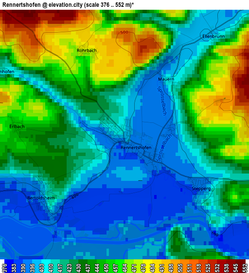
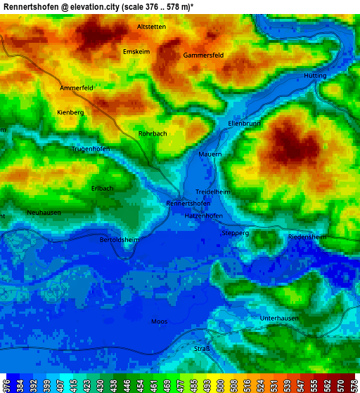
Below is the Elevation map of Rennertshofen, which displays elevation range with different colors. Scale of the first map is from 376 to 552 m (1234 to 1811 ft) with average elevation of 428.6 meters (=1406 ft) [note 1]
These maps also provides idea of topography and contour of this city, they are displayed at different zoom levels. More info about maps, scale and edge coordinates you can find below images.
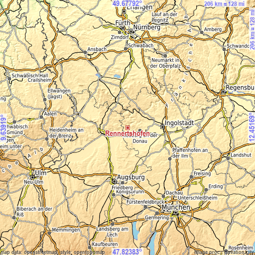
| \ | Map #1 | Map #2 | Topo.Map |
| Scale [m] | 376..552 m | 376..578 m | × |
| Scale [ft] | 1234..1811 ft | 1234..1896 ft | × |
| Average | 428.6 m = 1406 ft | 446.2 m = 1464 ft | × |
| Width | 6.44 km = 4 mi | 12.88 km = 8 mi | 206.2 km = 128.1 mi |
| Height | 6.44 km = 4 mi | 12.88 km = 8 mi | 206.1 km = 128.1 mi |
| ↑Max Latitude | 48.788391° | 48.817336° | 49.67792° |
| Latitude at center | 48.75943° | 48.75943° | 48.75943° |
| ↓Min Latitude | 48.730452° | 48.701457° | 47.82383° |
| ← Min Longitude | 11.001495° | 10.957549° | 9.63919° |
| Longitude center | 11.04544° | 11.04544° | 11.04544° |
| →Max Longitude | 11.089385° | 11.133331° | 12.45169° |
Nearby cities:
Cities around Rennertshofen sort by population:
• Neuburg an der Donau elevation 381 m
10.8 km,  106°
106°
• Rain 410 m
12.2 km,  230°
230°
• Burgheim 400 m
6.9 km,  198°
198°
• Ehekirchen 417 m
14.6 km,  164°
164°
• Marxheim 407 m
7.6 km,  254°
254°
• Oberhausen 421 m
6.4 km,  130°
130°
• Solnhofen 449 m
15.6 km,  346°
346°
• Buchdorf 539 m
15.8 km,  279°
279°
• Rohrenfels 392 m
11.5 km, 134°
• Niederschönenfeld 394 m
9.5 km,  239°
239°
• Genderkingen 398 m
13.6 km, 240°
• Tagmersheim 499 m
8.6 km,  317°
317°
Multilingual:
 En español:
Rennertshofen elevación 401 m.
 En France:
Rennertshofen élévation 401 m.
 Auf Deutsch:
Rennertshofen höhe über dem Meeresspiegel ist 401 m.

Sources and notes:
- [note 1] Map square and city borders are not equal. Map elevation data is calculated only from area inside that square.
- [src 1] Elevation data from geonames database provided with same terms of usage.
- [src 2] The elevation map of Rennertshofen is generated using elevation data from NASA's 3 arcsec (90m) resolution SRTM data.
- [src 3] Base (background) map © OpenStreetMap contributors tiles are generated by Geofabrik and OpenTopoMap.
Copyright & License:
This Rennertshofen Elevation Map is licensed under CC BY-SA. You may reuse any part from this page, if you give a proper credit by linking to this URL:
 More info on terms of use page.