Hehlen elevation
Hehlen (Lower Saxony), Germany elevation is 73 meters and Hehlen elevation in feet is 240 ft above sea level [src 1]. Hehlen is a seat of a fourth-order administrative division (feature code) with elevation that is 185 meters (607 ft) smaller than average city elevation in Germany.
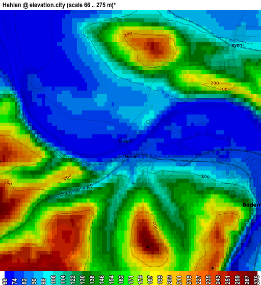
Below is the Elevation map of Hehlen, which displays elevation range with different colors. Scale of the first map is from 66 to 275 m (217 to 902 ft) with average elevation of 130.7 meters (=429 ft) [note 1]
These maps also provides idea of topography and contour of this city, they are displayed at different zoom levels. More info about maps, scale and edge coordinates you can find below images.
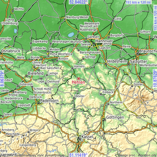
| \ | Map #1 | Topo.Map |
| Scale [m] | 66..275 m | × |
| Scale [ft] | 217..902 ft | × |
| Average | 130.7 m = 429 ft | × |
| Width | 6.02 km = 3.7 mi | 192.6 km = 119.7 mi |
| Height | 6.02 km = 3.7 mi | 192.6 km = 119.7 mi |
| ↑Max Latitude | 52.015634° | 52.84622° |
| Latitude at center | 51.98858° | 51.98858° |
| ↓Min Latitude | 51.961509° | 51.11419° |
| ← Min Longitude | 9.426095° | 8.06379° |
| Longitude center | 9.47004° | 9.47004° |
| →Max Longitude | 9.513985° | 10.87629° |
Nearby cities:
Cities around Hehlen sort by population:
• Hameln elevation 74 m
15 km,  328°
328°
• Bad Pyrmont 113 m
14.9 km,  268°
268°
• Salzhemmendorf 119 m
11.8 km,  42°
42°
• Coppenbrügge 136 m
15.4 km,  20°
20°
• Bodenwerder 95 m
3.9 km,  119°
119°
• Bevern 100 m
14.6 km,  173°
173°
• Eschershausen 155 m
13.7 km, 120°
• Halle 96 m
6.5 km,  87°
87°
• Ottenstein 290 m
6.3 km,  223°
223°
• Polle 92 m
11 km,  204°
204°
• Kirchbrak 116 m
7.6 km,  109°
109°
• Golmbach 138 m
11.3 km,  150°
150°
Multilingual:
 En español:
Hehlen elevación 73 m.
 En France:
Hehlen élévation 73 m.


Sources and notes:
- [note 1] Map square and city borders are not equal. Map elevation data is calculated only from area inside that square.
- [src 1] Elevation data from geonames database provided with same terms of usage.
- [src 2] The elevation map of Hehlen is generated using elevation data from NASA's 3 arcsec (90m) resolution SRTM data.
- [src 3] Base (background) map © OpenStreetMap contributors tiles are generated by Geofabrik and OpenTopoMap.
Copyright & License:
This Hehlen Elevation Map is licensed under CC BY-SA. You may reuse any part from this page, if you give a proper credit by linking to this URL:
 More info on terms of use page.