Bevern elevation
Bevern (Lower Saxony), Germany elevation is 100 meters and Bevern elevation in feet is 328 ft above sea level [src 1]. Bevern is a populated place (feature code) with elevation that is 158 meters (518 ft) smaller than average city elevation in Germany.
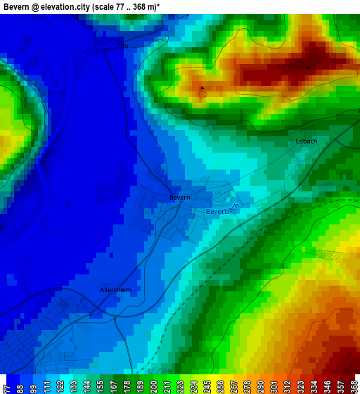
Below is the Elevation map of Bevern, which displays elevation range with different colors. Scale of the first map is from 77 to 368 m (253 to 1207 ft) with average elevation of 157.3 meters (=516 ft) [note 1]
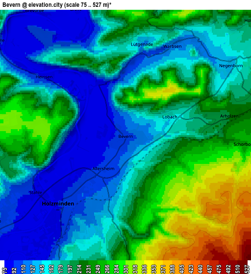
These maps also provides idea of topography and contour of this city, they are displayed at different zoom levels. More info about maps, scale and edge coordinates you can find below images.
| \ | Map #1 | Map #2 | Topo.Map |
| Scale [m] | 77..368 m | 75..527 m | × |
| Scale [ft] | 253..1207 ft | 246..1729 ft | × |
| Average | 157.3 m = 516 ft | 194.8 m = 639 ft | × |
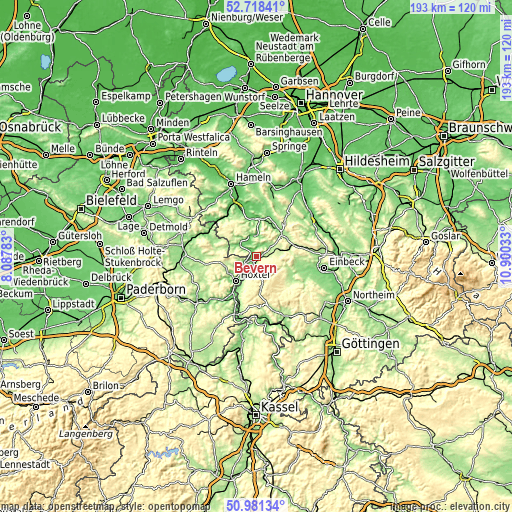
| Width | 6.04 km = 3.8 mi | 12.07 km = 7.5 mi | 193.1 km = 120 mi |
| Height | 6.04 km = 3.8 mi | 12.07 km = 7.5 mi | 193.1 km = 120 mi |
| ↑Max Latitude | 51.885393° | 51.912509° | 52.71841° |
| Latitude at center | 51.85826° | 51.85826° | 51.85826° |
| ↓Min Latitude | 51.831111° | 51.803945° | 50.98134° |
| ← Min Longitude | 9.450135° | 9.406189° | 8.08783° |
| Longitude center | 9.49408° | 9.49408° | 9.49408° |
| →Max Longitude | 9.538025° | 9.581971° | 10.90033° |
Nearby cities:
Cities around Bevern sort by population:
• Höxter elevation 100 m
12.1 km,  219°
219°
• Holzminden 91 m
4.7 km, 224°
• Bodenwerder 95 m
12.7 km,  7°
7°
• Stadtoldendorf 219 m
9.5 km,  73°
73°
• Eschershausen 155 m
12.7 km,  53°
53°
• Boffzen 89 m
14.2 km,  212°
212°
• Deensen 261 m
6.8 km,  87°
87°
• Ottenstein 290 m
11.5 km,  328°
328°
• Polle 92 m
7.7 km,  305°
305°
• Kirchbrak 116 m
13.2 km,  24°
24°
• Golmbach 138 m
6 km,  39°
39°
• Heinade 277 m
10 km,  106°
106°
Multilingual:
 En español:
Bevern elevación 100 m.
 En France:
Bevern élévation 100 m.


Sources and notes:
- [note 1] Map square and city borders are not equal. Map elevation data is calculated only from area inside that square.
- [src 1] Elevation data from geonames database provided with same terms of usage.
- [src 2] The elevation map of Bevern is generated using elevation data from NASA's 3 arcsec (90m) resolution SRTM data.
- [src 3] Base (background) map © OpenStreetMap contributors tiles are generated by Geofabrik and OpenTopoMap.
Copyright & License:
This Bevern Elevation Map is licensed under CC BY-SA. You may reuse any part from this page, if you give a proper credit by linking to this URL:
 More info on terms of use page.