Höxter elevation
Höxter (North Rhine-Westphalia, Regierungsbezirk Detmold), Germany elevation is 100 meters and Höxter elevation in feet is 328 ft above sea level [src 1]. Höxter is a seat of a third-order administrative division (feature code) with elevation that is 158 meters (518 ft) smaller than average city elevation in Germany.
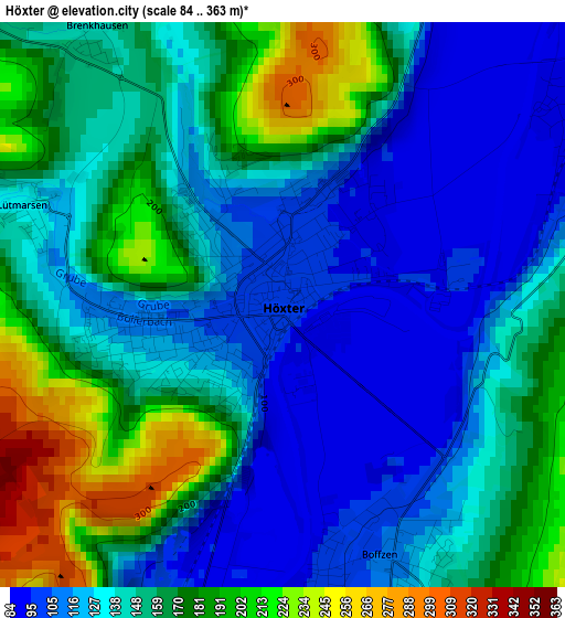
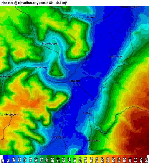
Below is the Elevation map of Höxter, which displays elevation range with different colors. Scale of the first map is from 84 to 363 m (276 to 1191 ft) with average elevation of 148.5 meters (=487 ft) [note 1]
These maps also provides idea of topography and contour of this city, they are displayed at different zoom levels. More info about maps, scale and edge coordinates you can find below images.
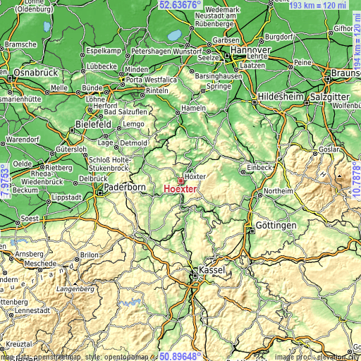
| \ | Map #1 | Map #2 | Topo.Map |
| Scale [m] | 84..363 m | 80..441 m | × |
| Scale [ft] | 276..1191 ft | 262..1447 ft | × |
| Average | 148.5 m = 487 ft | 206.3 m = 677 ft | × |
| Width | 6.05 km = 3.8 mi | 12.09 km = 7.5 mi | 193.5 km = 120.2 mi |
| Height | 6.05 km = 3.8 mi | 12.09 km = 7.5 mi | 193.5 km = 120.2 mi |
| ↑Max Latitude | 51.802193° | 51.82936° | 52.63676° |
| Latitude at center | 51.77501° | 51.77501° | 51.77501° |
| ↓Min Latitude | 51.747811° | 51.720595° | 50.89648° |
| ← Min Longitude | 9.337605° | 9.293659° | 7.9753° |
| Longitude center | 9.38155° | 9.38155° | 9.38155° |
| →Max Longitude | 9.425495° | 9.469441° | 10.7878° |
Nearby cities:
Cities around Höxter sort by population:
• Holzminden elevation 91 m
7.4 km,  36°
36°
• Brakel 136 m
14.9 km,  244°
244°
• Beverungen 103 m
11.9 km,  182°
182°
• Schieder-Schwalenberg 218 m
17.1 km,  311°
311°
• Bevern 100 m
12.1 km, 39°
• Bad Karlshafen 119 m
15.6 km,  161°
161°
• Boffzen 89 m
2.8 km, 177°
• Deensen 261 m
17.4 km,  56°
56°
• Fürstenberg 181 m
4.8 km, 164°
• Polle 92 m
13.8 km,  6°
6°
• Golmbach 138 m
18.1 km, 39°
• Heinade 277 m
18.5 km,  69°
69°
Multilingual:
 En español:
Höxter elevación 100 m.
 En France:
Höxter élévation 100 m.


Sources and notes:
- [note 1] Map square and city borders are not equal. Map elevation data is calculated only from area inside that square.
- [src 1] Elevation data from geonames database provided with same terms of usage.
- [src 2] The elevation map of Höxter is generated using elevation data from NASA's 3 arcsec (90m) resolution SRTM data.
- [src 3] Base (background) map © OpenStreetMap contributors tiles are generated by Geofabrik and OpenTopoMap.
Copyright & License:
This Höxter Elevation Map is licensed under CC BY-SA. You may reuse any part from this page, if you give a proper credit by linking to this URL:
 More info on terms of use page.