Golmbach elevation
Golmbach (Lower Saxony), Germany elevation is 138 meters and Golmbach elevation in feet is 453 ft above sea level [src 1]. Golmbach is a seat of a fourth-order administrative division (feature code) with elevation that is 120 meters (394 ft) smaller than average city elevation in Germany.
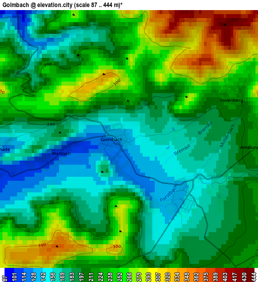
Below is the Elevation map of Golmbach, which displays elevation range with different colors. Scale of the first map is from 87 to 444 m (285 to 1457 ft) with average elevation of 213.3 meters (=700 ft) [note 1]
These maps also provides idea of topography and contour of this city, they are displayed at different zoom levels. More info about maps, scale and edge coordinates you can find below images.
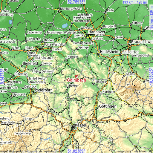
| \ | Map #1 | Topo.Map |
| Scale [m] | 87..444 m | × |
| Scale [ft] | 285..1457 ft | × |
| Average | 213.3 m = 700 ft | × |
| Width | 6.03 km = 3.7 mi | 193 km = 119.9 mi |
| Height | 6.03 km = 3.7 mi | 192.9 km = 119.9 mi |
| ↑Max Latitude | 51.927108° | 52.75935° |
| Latitude at center | 51.9° | 51.9° |
| ↓Min Latitude | 51.872876° | 51.02389° |
| ← Min Longitude | 9.506055° | 8.14375° |
| Longitude center | 9.55° | 9.55° |
| →Max Longitude | 9.593945° | 10.95625° |
Nearby cities:
Cities around Golmbach sort by population:
• Holzminden elevation 91 m
10.8 km,  221°
221°
• Bodenwerder 95 m
8.2 km,  345°
345°
• Stadtoldendorf 219 m
5.6 km,  110°
110°
• Bevern 100 m
6 km, 219°
• Eschershausen 155 m
7 km,  65°
65°
• Hehlen 73 m
11.3 km,  330°
330°
• Halle 96 m
10.2 km,  5°
5°
• Deensen 261 m
5.3 km,  145°
145°
• Ottenstein 290 m
11.1 km,  298°
298°
• Polle 92 m
10 km,  269°
269°
• Kirchbrak 116 m
7.5 km, 13°
• Heinade 277 m
9.4 km,  142°
142°
Multilingual:
 En español:
Golmbach elevación 138 m.
 En France:
Golmbach élévation 138 m.
 Auf Deutsch:
Golmbach höhe über dem Meeresspiegel ist 138 m.

Sources and notes:
- [note 1] Map square and city borders are not equal. Map elevation data is calculated only from area inside that square.
- [src 1] Elevation data from geonames database provided with same terms of usage.
- [src 2] The elevation map of Golmbach is generated using elevation data from NASA's 3 arcsec (90m) resolution SRTM data.
- [src 3] Base (background) map © OpenStreetMap contributors tiles are generated by Geofabrik and OpenTopoMap.
Copyright & License:
This Golmbach Elevation Map is licensed under CC BY-SA. You may reuse any part from this page, if you give a proper credit by linking to this URL:
 More info on terms of use page.