Hofheim in Unterfranken elevation
Hofheim in Unterfranken (Bavaria, Regierungsbezirk Unterfranken), Germany elevation is 266 meters and Hofheim in Unterfranken elevation in feet is 873 ft above sea level [src 1]. Hofheim in Unterfranken is a populated place (feature code) with elevation that is 8 meters (26 ft) bigger than average city elevation in Germany.
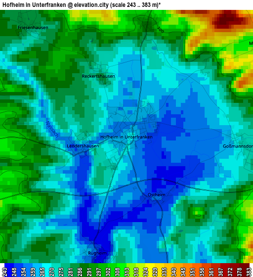
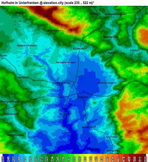
Below is the Elevation map of Hofheim in Unterfranken, which displays elevation range with different colors. Scale of the first map is from 243 to 383 m (797 to 1257 ft) with average elevation of 277.7 meters (=911 ft) [note 1]
These maps also provides idea of topography and contour of this city, they are displayed at different zoom levels. More info about maps, scale and edge coordinates you can find below images.
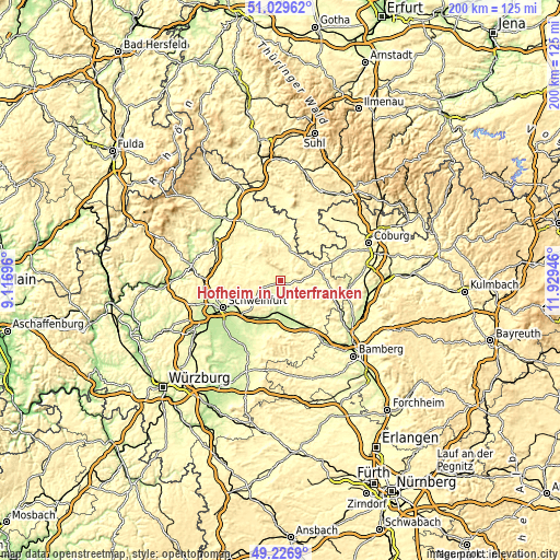
| \ | Map #1 | Map #2 | Topo.Map |
| Scale [m] | 243..383 m | 235..522 m | × |
| Scale [ft] | 797..1257 ft | 771..1713 ft | × |
| Average | 277.7 m = 911 ft | 320 m = 1050 ft | × |
| Width | 6.26 km = 3.9 mi | 12.53 km = 7.8 mi | 200.4 km = 124.5 mi |
| Height | 6.26 km = 3.9 mi | 12.53 km = 7.8 mi | 200.4 km = 124.5 mi |
| ↑Max Latitude | 50.164909° | 50.193051° | 51.02962° |
| Latitude at center | 50.13675° | 50.13675° | 50.13675° |
| ↓Min Latitude | 50.108575° | 50.080383° | 49.2269° |
| ← Min Longitude | 10.479265° | 10.435319° | 9.11696° |
| Longitude center | 10.52321° | 10.52321° | 10.52321° |
| →Max Longitude | 10.567155° | 10.611101° | 11.92946° |
Nearby cities:
Cities around Hofheim in Unterfranken sort by population:
• Haßfurt elevation 233 m
11.3 km,  182°
182°
• Knetzgau 247 m
17.2 km,  173°
173°
• Zeil 235 m
15 km,  160°
160°
• Stadtlauringen 292 m
12.8 km,  295°
295°
• Maroldsweisach 333 m
11.7 km,  56°
56°
• Wonfurt 219 m
13.9 km,  196°
196°
• Aidhausen 305 m
6.6 km,  282°
282°
• Sulzfeld 300 m
16 km,  328°
328°
• Pfarrweisach 299 m
15 km,  84°
84°
• Burgpreppach 303 m
9 km,  86°
86°
• Thundorf in Unterfranken 311 m
16.2 km, 296°
• Hellingen 300 m
17 km,  42°
42°
Multilingual:
 En español:
Hofheim in Unterfranken elevación 266 m.
 En France:
Hofheim in Unterfranken élévation 266 m.
 Auf Deutsch:
Hofheim in Unterfranken höhe über dem Meeresspiegel ist 266 m.
 На русском:
Hofheim in Unterfranken высота над уровнем моря 266 м
Sources and notes:
- [note 1] Map square and city borders are not equal. Map elevation data is calculated only from area inside that square.
- [src 1] Elevation data from geonames database provided with same terms of usage.
- [src 2] The elevation map of Hofheim in Unterfranken is generated using elevation data from NASA's 3 arcsec (90m) resolution SRTM data.
- [src 3] Base (background) map © OpenStreetMap contributors tiles are generated by Geofabrik and OpenTopoMap.
Copyright & License:
This Hofheim in Unterfranken Elevation Map is licensed under CC BY-SA. You may reuse any part from this page, if you give a proper credit by linking to this URL:
 More info on terms of use page.