Ruppichteroth elevation
Ruppichteroth (North Rhine-Westphalia, Regierungsbezirk Köln), Germany elevation is 169 meters and Ruppichteroth elevation in feet is 554 ft above sea level [src 1]. Ruppichteroth is a seat of a fourth-order administrative division (feature code) with elevation that is 89 meters (292 ft) smaller than average city elevation in Germany.
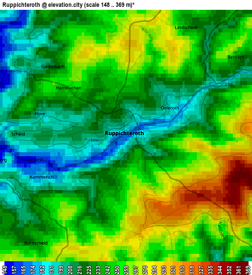
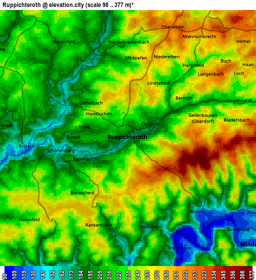
Below is the Elevation map of Ruppichteroth, which displays elevation range with different colors. Scale of the first map is from 148 to 369 m (486 to 1211 ft) with average elevation of 238.7 meters (=783 ft) [note 1]
These maps also provides idea of topography and contour of this city, they are displayed at different zoom levels. More info about maps, scale and edge coordinates you can find below images.
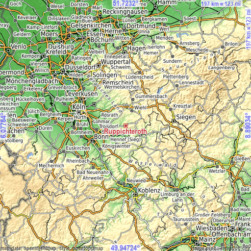
| \ | Map #1 | Map #2 | Topo.Map |
| Scale [m] | 148..369 m | 98..377 m | × |
| Scale [ft] | 486..1211 ft | 322..1237 ft | × |
| Average | 238.7 m = 783 ft | 231 m = 758 ft | × |
| Width | 6.17 km = 3.8 mi | 12.34 km = 7.7 mi | 197.5 km = 122.7 mi |
| Height | 6.17 km = 3.8 mi | 12.34 km = 7.7 mi | 197.5 km = 122.7 mi |
| ↑Max Latitude | 50.871411° | 50.899135° | 51.7232° |
| Latitude at center | 50.84367° | 50.84367° | 50.84367° |
| ↓Min Latitude | 50.815913° | 50.788139° | 49.94724° |
| ← Min Longitude | 7.440145° | 7.396199° | 6.07784° |
| Longitude center | 7.48409° | 7.48409° | 7.48409° |
| →Max Longitude | 7.528035° | 7.571981° | 8.89034° |
Nearby cities:
Cities around Ruppichteroth sort by population:
• Hennef elevation 70 m
16 km,  241°
241°
• Wiehl 197 m
12.7 km,  21°
21°
• Eitorf 102 m
8.9 km,  195°
195°
• Waldbröl 278 m
10 km,  69°
69°
• Nümbrecht 287 m
7.8 km,  30°
30°
• Much 226 m
8.8 km,  319°
319°
• Hamm 213 m
16.2 km,  122°
122°
• Pracht 196 m
14.8 km,  128°
128°
• Weyerbusch 294 m
14.9 km,  161°
161°
• Etzbach 161 m
16.1 km, 116°
• Fürthen 139 m
14.5 km, 117°
• Breitscheidt 238 m
15.6 km, 131°
Multilingual:
 En español:
Ruppichteroth elevación 169 m.
 En France:
Ruppichteroth élévation 169 m.
 Auf Deutsch:
Ruppichteroth höhe über dem Meeresspiegel ist 169 m.

Sources and notes:
- [note 1] Map square and city borders are not equal. Map elevation data is calculated only from area inside that square.
- [src 1] Elevation data from geonames database provided with same terms of usage.
- [src 2] The elevation map of Ruppichteroth is generated using elevation data from NASA's 3 arcsec (90m) resolution SRTM data.
- [src 3] Base (background) map © OpenStreetMap contributors tiles are generated by Geofabrik and OpenTopoMap.
Copyright & License:
This Ruppichteroth Elevation Map is licensed under CC BY-SA. You may reuse any part from this page, if you give a proper credit by linking to this URL:
 More info on terms of use page.