Breitscheidt elevation
Breitscheidt (Rheinland-Pfalz), Germany elevation is 238 meters and Breitscheidt elevation in feet is 781 ft above sea level [src 1]. Breitscheidt is a seat of a fourth-order administrative division (feature code) with elevation that is 20 meters (66 ft) smaller than average city elevation in Germany.
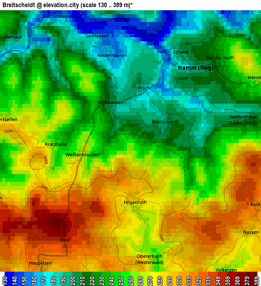
Below is the Elevation map of Breitscheidt, which displays elevation range with different colors. Scale of the first map is from 130 to 389 m (427 to 1276 ft) with average elevation of 253.8 meters (=833 ft) [note 1]
These maps also provides idea of topography and contour of this city, they are displayed at different zoom levels. More info about maps, scale and edge coordinates you can find below images.
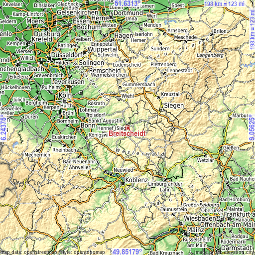
| \ | Map #1 | Topo.Map |
| Scale [m] | 130..389 m | × |
| Scale [ft] | 427..1276 ft | × |
| Average | 253.8 m = 833 ft | × |
| Width | 6.18 km = 3.8 mi | 197.9 km = 123 mi |
| Height | 6.18 km = 3.8 mi | 197.8 km = 122.9 mi |
| ↑Max Latitude | 50.777796° | 51.6313° |
| Latitude at center | 50.75° | 50.75° |
| ↓Min Latitude | 50.722187° | 49.85179° |
| ← Min Longitude | 7.606055° | 6.24375° |
| Longitude center | 7.65° | 7.65° |
| →Max Longitude | 7.693945° | 9.05625° |
Nearby cities:
Cities around Breitscheidt sort by population:
• Wissen elevation 193 m
6.8 km,  61°
61°
• Altenkirchen 217 m
7.1 km,  184°
184°
• Hamm 213 m
2.6 km,  48°
48°
• Birken-Honigsessen 237 m
9.4 km,  38°
38°
• Gebhardshain 377 m
11.7 km,  90°
90°
• Pracht 196 m
1.1 km,  355°
355°
• Roth 267 m
3.8 km,  68°
68°
• Weyerbusch 294 m
8 km,  242°
242°
• Etzbach 161 m
4.1 km, 40°
• Fürthen 139 m
3.9 km,  17°
17°
• Mittelhof 254 m
11.2 km,  75°
75°
• Mammelzen 236 m
5.7 km,  168°
168°
Multilingual:
 En español:
Breitscheidt elevación 238 m.
 En France:
Breitscheidt élévation 238 m.
 Auf Deutsch:
Breitscheidt höhe über dem Meeresspiegel ist 238 m.

Sources and notes:
- [note 1] Map square and city borders are not equal. Map elevation data is calculated only from area inside that square.
- [src 1] Elevation data from geonames database provided with same terms of usage.
- [src 2] The elevation map of Breitscheidt is generated using elevation data from NASA's 3 arcsec (90m) resolution SRTM data.
- [src 3] Base (background) map © OpenStreetMap contributors tiles are generated by Geofabrik and OpenTopoMap.
Copyright & License:
This Breitscheidt Elevation Map is licensed under CC BY-SA. You may reuse any part from this page, if you give a proper credit by linking to this URL:
 More info on terms of use page.