Wiehl elevation
Wiehl (North Rhine-Westphalia, Regierungsbezirk Köln), Germany elevation is 197 meters and Wiehl elevation in feet is 646 ft above sea level [src 1]. Wiehl is a populated place (feature code) with elevation that is 61 meters (200 ft) smaller than average city elevation in Germany.
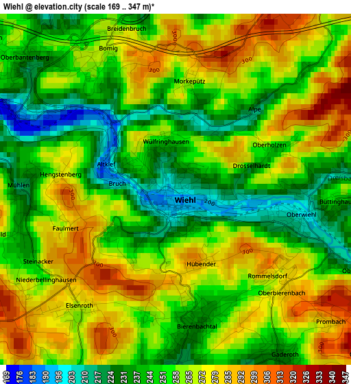
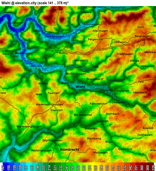
Below is the Elevation map of Wiehl, which displays elevation range with different colors. Scale of the first map is from 169 to 347 m (554 to 1138 ft) with average elevation of 258.7 meters (=849 ft) [note 1]
These maps also provides idea of topography and contour of this city, they are displayed at different zoom levels. More info about maps, scale and edge coordinates you can find below images.
| \ | Map #1 | Map #2 | Topo.Map |
| Scale [m] | 169..347 m | 141..378 m | × |
| Scale [ft] | 554..1138 ft | 463..1240 ft | × |
| Average | 258.7 m = 849 ft | 265.7 m = 872 ft | × |
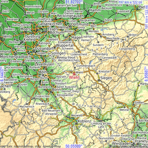
| Width | 6.16 km = 3.8 mi | 12.31 km = 7.6 mi | 197 km = 122.4 mi |
| Height | 6.16 km = 3.8 mi | 12.31 km = 7.6 mi | 197 km = 122.4 mi |
| ↑Max Latitude | 50.977178° | 51.004839° | 51.82702° |
| Latitude at center | 50.9495° | 50.9495° | 50.9495° |
| ↓Min Latitude | 50.921806° | 50.894095° | 50.05509° |
| ← Min Longitude | 7.506675° | 7.462729° | 6.14437° |
| Longitude center | 7.55062° | 7.55062° | 7.55062° |
| →Max Longitude | 7.594565° | 7.638511° | 8.95687° |
Nearby cities:
Cities around Wiehl sort by population:
• Gummersbach elevation 253 m
8.6 km,  6°
6°
• Lindlar 231 m
14.4 km,  302°
302°
• Meinerzhagen 399 m
18.8 km,  21°
21°
• Engelskirchen 144 m
10.5 km,  294°
294°
• Bergneustadt 248 m
11.2 km,  41°
41°
• Waldbröl 278 m
9.4 km,  150°
150°
• Nümbrecht 287 m
5.1 km,  187°
187°
• Much 226 m
11.5 km,  243°
243°
• Marienheide 356 m
14.9 km,  354°
354°
• Drolshagen 357 m
17.6 km,  62°
62°
• Morsbach 218 m
15.5 km,  126°
126°
• Ruppichteroth 169 m
12.7 km,  201°
201°
Multilingual:
 En español:
Wiehl elevación 197 m.
 En France:
Wiehl élévation 197 m.


Sources and notes:
- [note 1] Map square and city borders are not equal. Map elevation data is calculated only from area inside that square.
- [src 1] Elevation data from geonames database provided with same terms of usage.
- [src 2] The elevation map of Wiehl is generated using elevation data from NASA's 3 arcsec (90m) resolution SRTM data.
- [src 3] Base (background) map © OpenStreetMap contributors tiles are generated by Geofabrik and OpenTopoMap.
Copyright & License:
This Wiehl Elevation Map is licensed under CC BY-SA. You may reuse any part from this page, if you give a proper credit by linking to this URL:
 More info on terms of use page.