Piripiri elevation
Piripiri (Piauí), Brazil elevation is 164 meters and Piripiri elevation in feet is 538 ft above sea level [src 1]. Piripiri is a populated place (feature code) with elevation that is 218 meters (715 ft) smaller than average city elevation in Brazil.
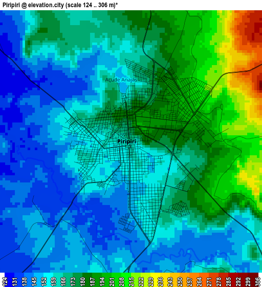
Below is the Elevation map of Piripiri, which displays elevation range with different colors. Scale of the first map is from 124 to 306 m (407 to 1004 ft) with average elevation of 167 meters (=548 ft) [note 1]
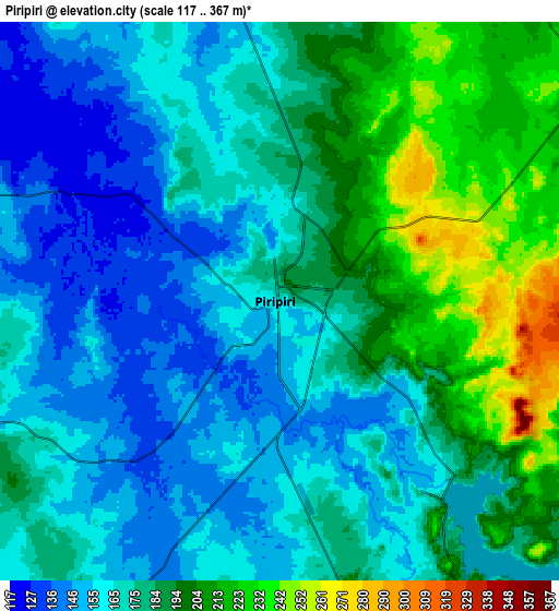
These maps also provides idea of topography and contour of this city, they are displayed at different zoom levels. More info about maps, scale and edge coordinates you can find below images.
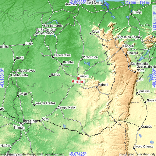
| \ | Map #1 | Map #2 | Topo.Map |
| Scale [m] | 124..306 m | 117..367 m | × |
| Scale [ft] | 407..1004 ft | 384..1204 ft | × |
| Average | 167 m = 548 ft | 177.6 m = 583 ft | × |
| Width | 9.75 km = 6.1 mi | 19.49 km = 12.1 mi | 311.8 km = 193.7 mi |
| Height | 9.75 km = 6.1 mi | 19.49 km = 12.1 mi | 311.9 km = 193.8 mi |
| ↑Max Latitude | -4.229506° | -4.185679° | -2.86985° |
| Latitude at center | -4.27333° | -4.27333° | -4.27333° |
| ↓Min Latitude | -4.317152° | -4.360971° | -5.67425° |
| ← Min Longitude | -41.820885° | -41.864831° | -43.18319° |
| Longitude center | -41.77694° | -41.77694° | -41.77694° |
| →Max Longitude | -41.732995° | -41.689049° | -40.37069° |
Nearby cities:
Cities around Piripiri sort by population:
• Tianguá elevation 773 m
105.9 km,  55°
55°
• Campo Maior 128 m
75.4 km,  215°
215°
• Pedro II 608 m
39.1 km,  115°
115°
• Barras 89 m
57.5 km,  273°
273°
• José de Freitas 131 m
103.5 km,  238°
238°
• Esperantina 63 m
65.4 km,  309°
309°
• Piracuruca 75 m
39.1 km,  11°
11°
• Ubajara 855 m
105.7 km, 63°
• Cocal 129 m
92.4 km,  15°
15°
• Ibiapina 897 m
105.8 km,  68°
68°
• Batalha 119 m
43.1 km, 309°
• Juá dos Vieiras 516 m
97.8 km,  32°
32°
Multilingual:
 En español:
Piripiri elevación 164 m.
 En France:
Piripiri élévation 164 m.
 Auf Deutsch:
Piripiri höhe über dem Meeresspiegel ist 164 m.

Sources and notes:
- [note 1] Map square and city borders are not equal. Map elevation data is calculated only from area inside that square.
- [src 1] Elevation data from geonames database provided with same terms of usage.
- [src 2] The elevation map of Piripiri is generated using elevation data from NASA's 3 arcsec (90m) resolution SRTM data.
- [src 3] Base (background) map © OpenStreetMap contributors tiles are generated by Geofabrik and OpenTopoMap.
Copyright & License:
This Piripiri Elevation Map is licensed under CC BY-SA. You may reuse any part from this page, if you give a proper credit by linking to this URL:
 More info on terms of use page.