Stara Zagora elevation
Stara Zagora, Bulgaria elevation is 205 meters and Stara Zagora elevation in feet is 673 ft above sea level [src 1]. Stara Zagora is a seat of a first-order administrative division (feature code) with elevation that is 114 meters (374 ft) smaller than average city elevation in Bulgaria.
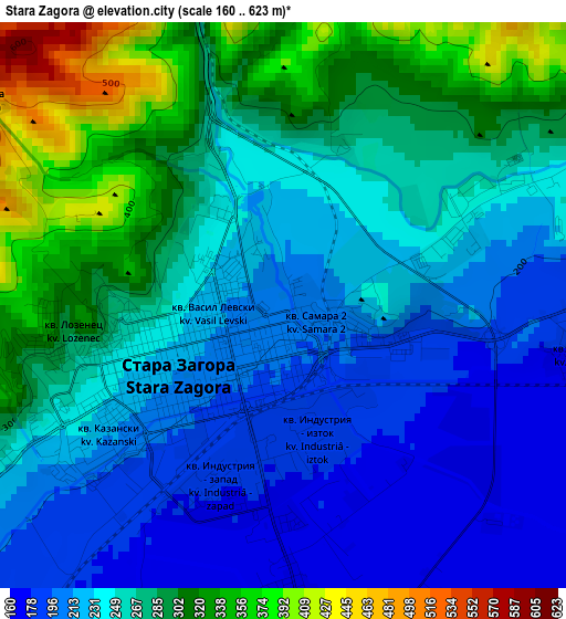
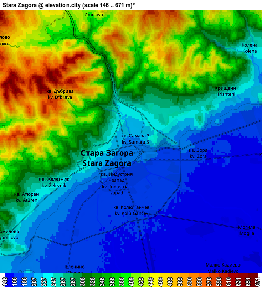
Below is the Elevation map of Stara Zagora, which displays elevation range with different colors. Scale of the first map is from 160 to 623 m (525 to 2044 ft) with average elevation of 256.4 meters (=841 ft) [note 1]
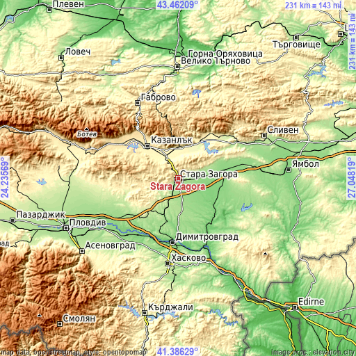
These maps also provides idea of topography and contour of this city, they are displayed at different zoom levels. More info about maps, scale and edge coordinates you can find below images.
| \ | Map #1 | Map #2 | Topo.Map |
| Scale [m] | 160..623 m | 146..671 m | × |
| Scale [ft] | 525..2044 ft | 479..2201 ft | × |
| Average | 256.4 m = 841 ft | 296.2 m = 972 ft | × |
| Width | 7.21 km = 4.5 mi | 14.43 km = 9 mi | 230.8 km = 143.4 mi |
| Height | 7.21 km = 4.5 mi | 14.43 km = 9 mi | 230.8 km = 143.4 mi |
| ↑Max Latitude | 42.465206° | 42.497616° | 43.46209° |
| Latitude at center | 42.43278° | 42.43278° | 42.43278° |
| ↓Min Latitude | 42.400337° | 42.367877° | 41.38629° |
| ← Min Longitude | 25.597995° | 25.554049° | 24.23569° |
| Longitude center | 25.64194° | 25.64194° | 25.64194° |
| →Max Longitude | 25.685885° | 25.729831° | 27.04819° |
Nearby cities:
Cities around Stara Zagora sort by population:
• Kazanlak elevation 366 m
28.5 km,  315°
315°
• Nova Zagora 130 m
31.2 km,  79°
79°
• Chirpan 195 m
36.2 km,  224°
224°
• Radnevo 116 m
28.1 km,  121°
121°
• Gŭlŭbovo 144 m
37.4 km,  152°
152°
• Tvarditsa 350 m
36.5 km,  35°
35°
• Maglizh 353 m
20.1 km,  337°
337°
• Pavel Banya 411 m
40.7 km,  297°
297°
• Nikolaevo 277 m
25.8 km,  30°
30°
• Gurkovo 375 m
29.1 km, 26°
• Shipka 692 m
40.4 km, 321°
• Elkhovo 359 m
18 km,  252°
252°
Multilingual:
 En español:
Stara Zagora elevación 205 m.
 En France:
Stara Zagora élévation 205 m.
 Auf Deutsch:
Stara Sagora höhe über dem Meeresspiegel ist 205 m.

Sources and notes:
- [note 1] Map square and city borders are not equal. Map elevation data is calculated only from area inside that square.
- [src 1] Elevation data from geonames database provided with same terms of usage.
- [src 2] The elevation map of Stara Zagora is generated using elevation data from NASA's 3 arcsec (90m) resolution SRTM data.
- [src 3] Base (background) map © OpenStreetMap contributors tiles are generated by Geofabrik and OpenTopoMap.
Copyright & License:
This Stara Zagora Elevation Map is licensed under CC BY-SA. You may reuse any part from this page, if you give a proper credit by linking to this URL:
 More info on terms of use page.