Radnevo elevation
Radnevo (Stara Zagora, Obshtina Radnevo), Bulgaria elevation is 116 meters and Radnevo elevation in feet is 381 ft above sea level [src 1]. Radnevo is a populated place (feature code) with elevation that is 203 meters (666 ft) smaller than average city elevation in Bulgaria.
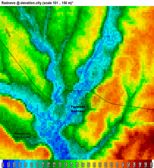
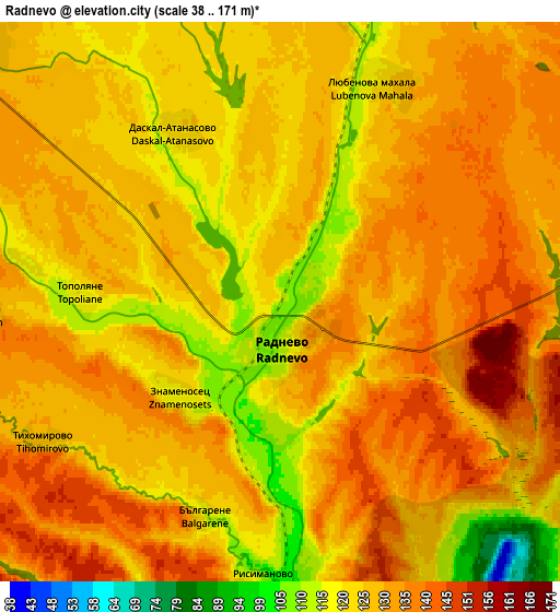
Below is the Elevation map of Radnevo, which displays elevation range with different colors. Scale of the first map is from 101 to 150 m (331 to 492 ft) with average elevation of 123.4 meters (=405 ft) [note 1]
These maps also provides idea of topography and contour of this city, they are displayed at different zoom levels. More info about maps, scale and edge coordinates you can find below images.
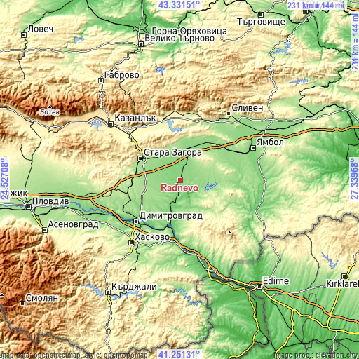
| \ | Map #1 | Map #2 | Topo.Map |
| Scale [m] | 101..150 m | 38..171 m | × |
| Scale [ft] | 331..492 ft | 125..561 ft | × |
| Average | 123.4 m = 405 ft | 128 m = 420 ft | × |
| Width | 7.23 km = 4.5 mi | 14.46 km = 9 mi | 231.3 km = 143.7 mi |
| Height | 7.23 km = 4.5 mi | 14.46 km = 9 mi | 231.3 km = 143.7 mi |
| ↑Max Latitude | 42.332495° | 42.364973° | 43.33151° |
| Latitude at center | 42.3° | 42.3° | 42.3° |
| ↓Min Latitude | 42.267488° | 42.23496° | 41.25131° |
| ← Min Longitude | 25.889385° | 25.845439° | 24.52708° |
| Longitude center | 25.93333° | 25.93333° | 25.93333° |
| →Max Longitude | 25.977275° | 26.021221° | 27.33958° |
Nearby cities:
Cities around Radnevo sort by population:
• Stara Zagora elevation 205 m
28.1 km,  301°
301°
• Dimitrovgrad 111 m
39.1 km,  224°
224°
• Nova Zagora 130 m
21.5 km,  18°
18°
• Harmanli 74 m
40.9 km,  183°
183°
• Gŭlŭbovo 144 m
19.8 km,  200°
200°
• Simeonovgrad 104 m
30.8 km, 195°
• Tvarditsa 350 m
44.6 km,  356°
356°
• Topolovgrad 328 m
40.8 km,  126°
126°
• Nikolaevo 277 m
38.6 km,  343°
343°
• Gurkovo 375 m
42.2 km, 344°
• Kermen 169 m
34.2 km,  49°
49°
• Elkhovo 359 m
42.1 km,  282°
282°
Multilingual:
 En español:
Radnevo elevación 116 m.
 En France:
Radnevo élévation 116 m.


Sources and notes:
- [note 1] Map square and city borders are not equal. Map elevation data is calculated only from area inside that square.
- [src 1] Elevation data from geonames database provided with same terms of usage.
- [src 2] The elevation map of Radnevo is generated using elevation data from NASA's 3 arcsec (90m) resolution SRTM data.
- [src 3] Base (background) map © OpenStreetMap contributors tiles are generated by Geofabrik and OpenTopoMap.
Copyright & License:
This Radnevo Elevation Map is licensed under CC BY-SA. You may reuse any part from this page, if you give a proper credit by linking to this URL:
 More info on terms of use page.