Binga elevation
Binga (Matabeleland North), Zimbabwe elevation is 628 meters and Binga elevation in feet is 2060 ft above sea level [src 1]. Binga is a populated place (feature code) with elevation that is 572 meters (1877 ft) smaller than average city elevation in Zimbabwe.
Below is the Elevation map of Binga, which displays elevation range with different colors. Scale of the first map is from 486 to 636 m (1594 to 2087 ft) with average elevation of 526.5 meters (=1727 ft) [note 1]
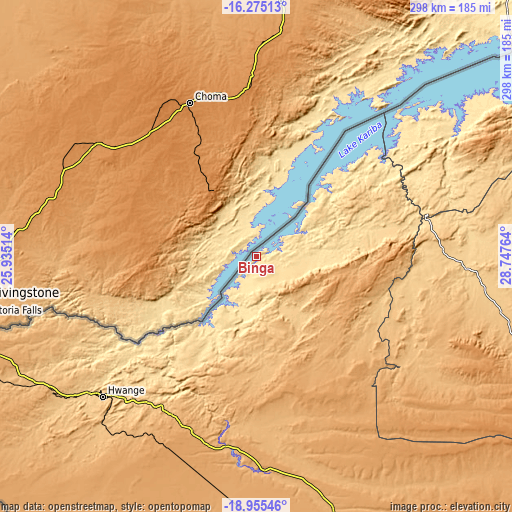
These maps also provides idea of topography and contour of this city, they are displayed at different zoom levels. More info about maps, scale and edge coordinates you can find below images.
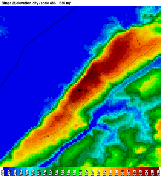
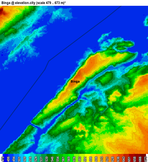
| \ | Map #1 | Map #2 | Topo.Map |
| Scale [m] | 486..636 m | 479..673 m | × |
| Scale [ft] | 1594..2087 ft | 1572..2208 ft | × |
| Average | 526.5 m = 1727 ft | 526.4 m = 1727 ft | × |
| Width | 9.31 km = 5.8 mi | 18.63 km = 11.6 mi | 298 km = 185.2 mi |
| Height | 9.31 km = 5.8 mi | 18.63 km = 11.6 mi | 298 km = 185.2 mi |
| ↑Max Latitude | -17.578382° | -17.536483° | -16.27513° |
| Latitude at center | -17.62027° | -17.62027° | -17.62027° |
| ↓Min Latitude | -17.662149° | -17.704018° | -18.95546° |
| ← Min Longitude | 27.297445° | 27.253499° | 25.93514° |
| Longitude center | 27.34139° | 27.34139° | 27.34139° |
| →Max Longitude | 27.385335° | 27.429281° | 28.74764° |
Nearby cities:
Cities around Binga sort by population:
• Kadoma elevation 1176 m
283.5 km,  106°
106°
• Victoria Falls 961 m
163.7 km,  257°
257°
• Hwange 767 m
121.6 km,  227°
227°
• Kariba 679 m
197.7 km,  51°
51°
• Karoi 1259 m
265.5 km,  70°
70°
• Gokwe 1237 m
180.7 km, 111°
• Inyati 1333 m
278.2 km,  145°
145°
• Chakari 1107 m
274.5 km,  100°
100°
• Dete 1112 m
121.6 km,  204°
204°
• Chirundu 402 m
238.6 km,  42°
42°
• Kamativi Mine 953 m
83 km, 201°
• Lupane 1016 m
153.9 km,  161°
161°
Multilingual:
 En español:
Binga elevación 628 m.
 En France:
Binga élévation 628 m.


Sources and notes:
- [note 1] Map square and city borders are not equal. Map elevation data is calculated only from area inside that square.
- [src 1] Elevation data from geonames database provided with same terms of usage.
- [src 2] The elevation map of Binga is generated using elevation data from NASA's 3 arcsec (90m) resolution SRTM data.
- [src 3] Base (background) map © OpenStreetMap contributors tiles are generated by Geofabrik and OpenTopoMap.
Copyright & License:
This Binga Elevation Map is licensed under CC BY-SA. You may reuse any part from this page, if you give a proper credit by linking to this URL:
 More info on terms of use page.