Prieska elevation
Prieska (Northern Cape, Pixley ka Seme District Municipality), South Africa elevation is 942 meters and Prieska elevation in feet is 3091 ft above sea level [src 1]. Prieska is a seat of a third-order administrative division (feature code) with elevation that is 30 meters (98 ft) smaller than average city elevation in South Africa.
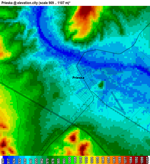
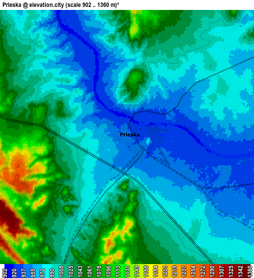
Below is the Elevation map of Prieska, which displays elevation range with different colors. Scale of the first map is from 909 to 1107 m (2982 to 3632 ft) with average elevation of 965.6 meters (=3168 ft) [note 1]
These maps also provides idea of topography and contour of this city, they are displayed at different zoom levels. More info about maps, scale and edge coordinates you can find below images.
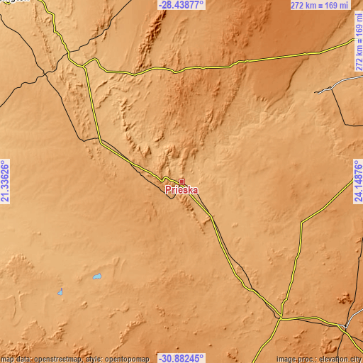
| \ | Map #1 | Map #2 | Topo.Map |
| Scale [m] | 909..1107 m | 902..1360 m | × |
| Scale [ft] | 2982..3632 ft | 2959..4462 ft | × |
| Average | 965.6 m = 3168 ft | 1005.7 m = 3300 ft | × |
| Width | 8.49 km = 5.3 mi | 16.98 km = 10.6 mi | 271.7 km = 168.8 mi |
| Height | 8.49 km = 5.3 mi | 16.98 km = 10.6 mi | 271.7 km = 168.8 mi |
| ↑Max Latitude | -29.629838° | -29.591632° | -28.43877° |
| Latitude at center | -29.66803° | -29.66803° | -29.66803° |
| ↓Min Latitude | -29.706207° | -29.74437° | -30.88245° |
| ← Min Longitude | 22.698565° | 22.654619° | 21.33626° |
| Longitude center | 22.74251° | 22.74251° | 22.74251° |
| →Max Longitude | 22.786455° | 22.830401° | 24.14876° |
Nearby cities:
Cities around Prieska sort by population:
• De Aar elevation 1247 m
163.8 km,  131°
131°
• Postmasburg 1305 m
151.6 km,  11°
11°
• Daniëlskuil 1468 m
181.9 km,  25°
25°
• Ritchie 1115 m
193.4 km,  68°
68°
• Carnarvon 1249 m
156 km,  202°
202°
• Kenhardt 805 m
157.5 km,  283°
283°
• Van Wyksvlei 962 m
116.5 km,  229°
229°
• Orania 1111 m
162 km,  95°
95°
• Petrusville 1199 m
190.4 km, 103°
• Hopetown 1095 m
129.8 km,  87°
87°
• Douglas 992 m
121 km,  55°
55°
• Groblershoop 868 m
113.1 km,  319°
319°
Multilingual:
 En español:
Prieska elevación 942 m.
 En France:
Prieska élévation 942 m.


Sources and notes:
- [note 1] Map square and city borders are not equal. Map elevation data is calculated only from area inside that square.
- [src 1] Elevation data from geonames database provided with same terms of usage.
- [src 2] The elevation map of Prieska is generated using elevation data from NASA's 3 arcsec (90m) resolution SRTM data.
- [src 3] Base (background) map © OpenStreetMap contributors tiles are generated by Geofabrik and OpenTopoMap.
Copyright & License:
This Prieska Elevation Map is licensed under CC BY-SA. You may reuse any part from this page, if you give a proper credit by linking to this URL:
 More info on terms of use page.