Upington elevation
Upington (Northern Cape, Siyanda District Municipality), South Africa elevation is 808 meters and Upington elevation in feet is 2651 ft above sea level [src 1]. Upington is a seat of a second-order administrative division (feature code) with elevation that is 164 meters (538 ft) smaller than average city elevation in South Africa.
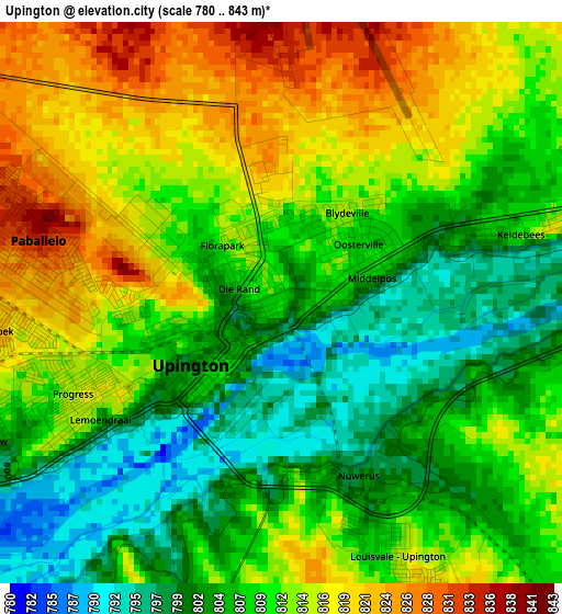
Below is the Elevation map of Upington, which displays elevation range with different colors. Scale of the first map is from 780 to 843 m (2559 to 2766 ft) with average elevation of 810.1 meters (=2658 ft) [note 1]
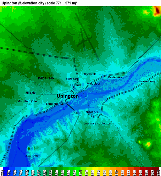
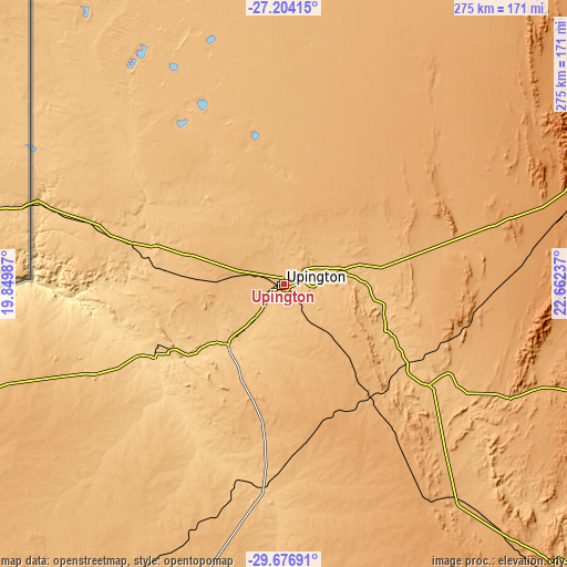
These maps also provides idea of topography and contour of this city, they are displayed at different zoom levels. More info about maps, scale and edge coordinates you can find below images.
| \ | Map #1 | Map #2 | Topo.Map |
| Scale [m] | 780..843 m | 771..971 m | × |
| Scale [ft] | 2559..2766 ft | 2530..3186 ft | × |
| Average | 810.1 m = 2658 ft | 823.4 m = 2701 ft | × |
| Width | 8.59 km = 5.3 mi | 17.19 km = 10.7 mi | 274.9 km = 170.8 mi |
| Height | 8.59 km = 5.3 mi | 17.19 km = 10.7 mi | 275 km = 170.9 mi |
| ↑Max Latitude | -28.409114° | -28.370454° | -27.20415° |
| Latitude at center | -28.44776° | -28.44776° | -28.44776° |
| ↓Min Latitude | -28.486392° | -28.52501° | -29.67691° |
| ← Min Longitude | 21.212175° | 21.168229° | 19.84987° |
| Longitude center | 21.25612° | 21.25612° | 21.25612° |
| →Max Longitude | 21.300065° | 21.344011° | 22.66237° |
Nearby cities:
Cities around Upington sort by population:
• Postmasburg elevation 1305 m
177.4 km,  85°
85°
• Prieska 942 m
198.2 km,  133°
133°
• Daniëlskuil 1468 m
225.3 km,  82°
82°
• Kathu 1233 m
194.8 km,  64°
64°
• Kuruman 1323 m
240.7 km, 62°
• Kenhardt 805 m
100.3 km,  185°
185°
• Pofadder 992 m
196.5 km,  247°
247°
• Brandvlei 921 m
236.4 km,  198°
198°
• Van Wyksvlei 962 m
218.7 km,  165°
165°
• Douglas 992 m
254.6 km,  105°
105°
• Groblershoop 868 m
86.7 km, 125°
• Kakamas 664 m
72.3 km,  239°
239°
Multilingual:
 En español:
Upington elevación 808 m.
 En France:
Upington élévation 808 m.
 Auf Deutsch:
Upington höhe über dem Meeresspiegel ist 808 m.

Sources and notes:
- [note 1] Map square and city borders are not equal. Map elevation data is calculated only from area inside that square.
- [src 1] Elevation data from geonames database provided with same terms of usage.
- [src 2] The elevation map of Upington is generated using elevation data from NASA's 3 arcsec (90m) resolution SRTM data.
- [src 3] Base (background) map © OpenStreetMap contributors tiles are generated by Geofabrik and OpenTopoMap.
Copyright & License:
This Upington Elevation Map is licensed under CC BY-SA. You may reuse any part from this page, if you give a proper credit by linking to this URL:
 More info on terms of use page.