Hillsborough elevation
Hillsborough (New Hampshire, Hillsborough County), United States elevation is 198 meters and Hillsborough elevation in feet is 650 ft above sea level [src 1]. Hillsborough is a populated place (feature code) with elevation that is 81 meters (266 ft) smaller than average city elevation in United States.
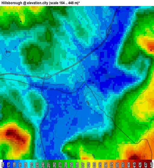
Below is the Elevation map of Hillsborough, which displays elevation range with different colors. Scale of the first map is from 164 to 448 m (538 to 1470 ft) with average elevation of 239.9 meters (=787 ft) [note 1]
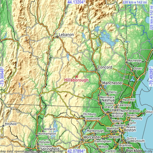
These maps also provides idea of topography and contour of this city, they are displayed at different zoom levels. More info about maps, scale and edge coordinates you can find below images.
| \ | Map #1 | Topo.Map |
| Scale [m] | 164..448 m | × |
| Scale [ft] | 538..1470 ft | × |
| Average | 239.9 m = 787 ft | × |
| Width | 7.13 km = 4.4 mi | 228.3 km = 141.9 mi |
| Height | 7.13 km = 4.4 mi | 228.3 km = 141.9 mi |
| ↑Max Latitude | 43.146171° | 44.13204° |
| Latitude at center | 43.1141° | 43.1141° |
| ↓Min Latitude | 43.082012° | 42.07894° |
| ← Min Longitude | -71.943145° | -73.30545° |
| Longitude center | -71.8992° | -71.8992° |
| →Max Longitude | -71.855255° | -70.49295° |
Nearby cities:
Cities around Hillsborough sort by population:
• Weare elevation 194 m
13.9 km,  98°
98°
• Hopkinton 157 m
20.1 km,  64°
64°
• New Boston 151 m
22.7 km,  132°
132°
• Deering 334 m
6.4 km,  135°
135°
• Greenfield 262 m
18.3 km,  173°
173°
• Henniker 137 m
9.6 km,  40°
40°
• Lyndeborough 270 m
25.4 km,  154°
154°
• Sutton 227 m
24.8 km,  350°
350°
• Francestown 258 m
15.7 km, 153°
• Contoocook 113 m
19.2 km,  51°
51°
• Antrim 218 m
9.8 km,  199°
199°
• Harrisville 416 m
24.7 km,  220°
220°
Multilingual:
 En español:
Hillsborough elevación 198 m.
 En France:
Hillsborough élévation 198 m.
 Auf Deutsch:
Hillsborough höhe über dem Meeresspiegel ist 198 m.

Sources and notes:
- [note 1] Map square and city borders are not equal. Map elevation data is calculated only from area inside that square.
- [src 1] Elevation data from geonames database provided with same terms of usage.
- [src 2] The elevation map of Hillsborough is generated using elevation data from NASA's 3 arcsec (90m) resolution SRTM data.
- [src 3] Base (background) map © OpenStreetMap contributors tiles are generated by Geofabrik and OpenTopoMap.
Copyright & License:
This Hillsborough Elevation Map is licensed under CC BY-SA. You may reuse any part from this page, if you give a proper credit by linking to this URL:
 More info on terms of use page.