Antrim elevation
Antrim (New Hampshire, Hillsborough County), United States elevation is 218 meters and Antrim elevation in feet is 715 ft above sea level [src 1]. Antrim is a populated place (feature code) with elevation that is 61 meters (200 ft) smaller than average city elevation in United States.
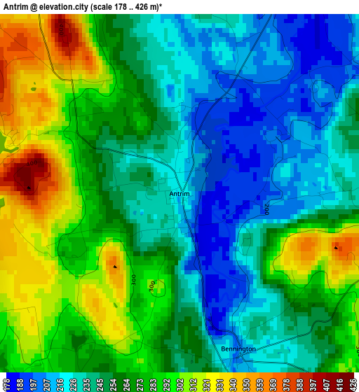
Below is the Elevation map of Antrim, which displays elevation range with different colors. Scale of the first map is from 178 to 426 m (584 to 1398 ft) with average elevation of 261 meters (=856 ft) [note 1]
These maps also provides idea of topography and contour of this city, they are displayed at different zoom levels. More info about maps, scale and edge coordinates you can find below images.
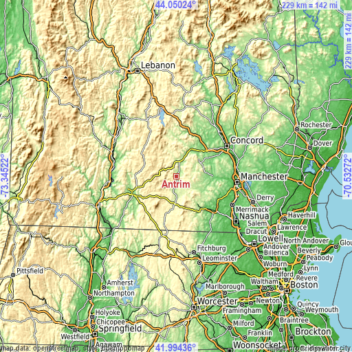
| \ | Map #1 | Topo.Map |
| Scale [m] | 178..426 m | × |
| Scale [ft] | 584..1398 ft | × |
| Average | 261 m = 856 ft | × |
| Width | 7.14 km = 4.4 mi | 228.6 km = 142 mi |
| Height | 7.14 km = 4.4 mi | 228.6 km = 142 mi |
| ↑Max Latitude | 43.063025° | 44.05024° |
| Latitude at center | 43.03091° | 43.03091° |
| ↓Min Latitude | 42.998778° | 41.99436° |
| ← Min Longitude | -71.982915° | -73.34522° |
| Longitude center | -71.93897° | -71.93897° |
| →Max Longitude | -71.895025° | -70.53272° |
Nearby cities:
Cities around Antrim sort by population:
• Weare elevation 194 m
18.4 km,  67°
67°
• New Boston 151 m
20.8 km,  106°
106°
• Peterborough 227 m
17.9 km,  183°
183°
• Deering 334 m
9 km,  58°
58°
• Hillsborough 198 m
9.8 km,  19°
19°
• Greenfield 262 m
10.4 km,  148°
148°
• Henniker 137 m
19.1 km,  29°
29°
• Lyndeborough 270 m
19.6 km,  134°
134°
• Dublin 462 m
17 km,  216°
216°
• Francestown 258 m
11.3 km,  115°
115°
• Temple 313 m
24.7 km,  163°
163°
• Harrisville 416 m
16 km,  233°
233°
Multilingual:
 En español:
Antrim elevación 218 m.
 En France:
Antrim élévation 218 m.


Sources and notes:
- [note 1] Map square and city borders are not equal. Map elevation data is calculated only from area inside that square.
- [src 1] Elevation data from geonames database provided with same terms of usage.
- [src 2] The elevation map of Antrim is generated using elevation data from NASA's 3 arcsec (90m) resolution SRTM data.
- [src 3] Base (background) map © OpenStreetMap contributors tiles are generated by Geofabrik and OpenTopoMap.
Copyright & License:
This Antrim Elevation Map is licensed under CC BY-SA. You may reuse any part from this page, if you give a proper credit by linking to this URL:
 More info on terms of use page.