Alliance elevation
Alliance (Nebraska, Box Butte County), United States elevation is 1214 meters and Alliance elevation in feet is 3983 ft above sea level [src 1]. Alliance is a seat of a second-order administrative division (feature code) with elevation that is 935 meters (3068 ft) bigger than average city elevation in United States.
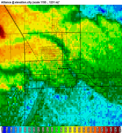
Below is the Elevation map of Alliance, which displays elevation range with different colors. Scale of the first map is from 1193 to 1231 m (3914 to 4039 ft) with average elevation of 1208.4 meters (=3965 ft) [note 1]
These maps also provides idea of topography and contour of this city, they are displayed at different zoom levels. More info about maps, scale and edge coordinates you can find below images.
| \ | Map #1 | Map #2 | Topo.Map |
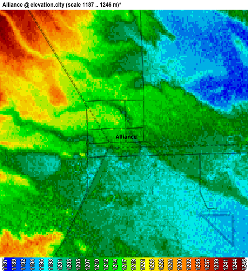
| Scale [m] | 1193..1231 m | 1187..1246 m | × |
| Scale [ft] | 3914..4039 ft | 3894..4088 ft | × |
| Average | 1208.4 m = 3965 ft | 1208.3 m = 3964 ft | × |
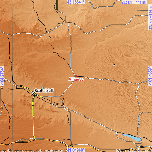
| Width | 7.25 km = 4.5 mi | 14.5 km = 9 mi | 232 km = 144.2 mi |
| Height | 7.25 km = 4.5 mi | 14.5 km = 9 mi | 232 km = 144.2 mi |
| ↑Max Latitude | 42.134227° | 42.166808° | 43.13641° |
| Latitude at center | 42.10163° | 42.10163° | 42.10163° |
| ↓Min Latitude | 42.069016° | 42.036385° | 41.04968° |
| ← Min Longitude | -102.916095° | -102.960041° | -104.2784° |
| Longitude center | -102.87215° | -102.87215° | -102.87215° |
| →Max Longitude | -102.828205° | -102.784259° | -101.4659° |
Nearby cities:
Cities around Alliance sort by population:
• Scottsbluff elevation 1187 m
70.7 km,  248°
248°
• Gering 1194 m
72 km,  244°
244°
• Chadron 1033 m
81.6 km,  352°
352°
• Mitchell 1203 m
79.4 km,  256°
256°
• Gordon 1084 m
95.5 km,  35°
35°
• Bridgeport 1121 m
52 km,  201°
201°
• Terrytown 1183 m
71.1 km, 246°
• Bayard 1148 m
53.7 km,  224°
224°
• Rushville 1140 m
76.3 km,  26°
26°
• Oshkosh 1035 m
89 km,  150°
150°
• Hyannis 1144 m
92.4 km,  96°
96°
• Harrisburg 1368 m
94 km,  229°
229°
Multilingual:
 En español:
Alliance elevación 1214 m.
 En France:
Alliance élévation 1214 m.
 Auf Deutsch:
Alliance höhe über dem Meeresspiegel ist 1214 m.

Sources and notes:
- [note 1] Map square and city borders are not equal. Map elevation data is calculated only from area inside that square.
- [src 1] Elevation data from geonames database provided with same terms of usage.
- [src 2] The elevation map of Alliance is generated using elevation data from NASA's 3 arcsec (90m) resolution SRTM data.
- [src 3] Base (background) map © OpenStreetMap contributors tiles are generated by Geofabrik and OpenTopoMap.
Copyright & License:
This Alliance Elevation Map is licensed under CC BY-SA. You may reuse any part from this page, if you give a proper credit by linking to this URL:
 More info on terms of use page.