Plains elevation
Plains (Montana, Sanders County), United States elevation is 754 meters and Plains elevation in feet is 2474 ft above sea level [src 1]. Plains is a populated place (feature code) with elevation that is 475 meters (1558 ft) bigger than average city elevation in United States.
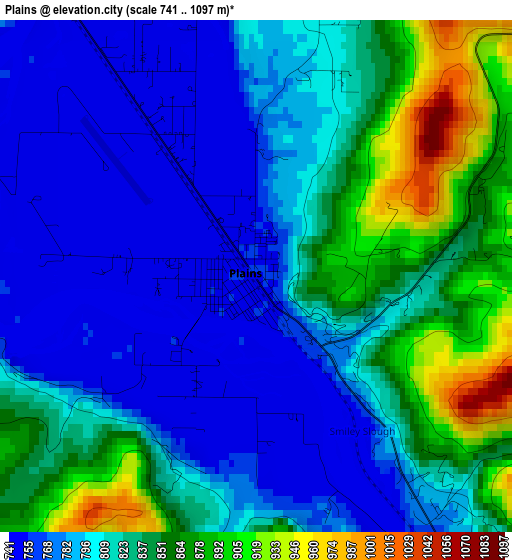
Below is the Elevation map of Plains, which displays elevation range with different colors. Scale of the first map is from 741 to 1097 m (2431 to 3599 ft) with average elevation of 814.8 meters (=2673 ft) [note 1]
These maps also provides idea of topography and contour of this city, they are displayed at different zoom levels. More info about maps, scale and edge coordinates you can find below images.
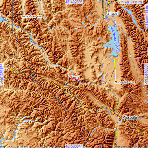
| \ | Map #1 | Topo.Map |
| Scale [m] | 741..1097 m | × |
| Scale [ft] | 2431..3599 ft | × |
| Average | 814.8 m = 2673 ft | × |
| Width | 6.61 km = 4.1 mi | 211.4 km = 131.4 mi |
| Height | 6.61 km = 4.1 mi | 211.4 km = 131.4 mi |
| ↑Max Latitude | 47.489913° | 48.40239° |
| Latitude at center | 47.46021° | 47.46021° |
| ↓Min Latitude | 47.43049° | 46.50084° |
| ← Min Longitude | -114.926855° | -116.28916° |
| Longitude center | -114.88291° | -114.88291° |
| →Max Longitude | -114.838965° | -113.47666° |
Nearby cities:
Cities around Plains sort by population:
• Orchard Homes elevation 962 m
91.6 km,  136°
136°
• Polson 892 m
59.9 km,  64°
64°
• Bigfork 908 m
90.4 km,  42°
42°
• Lakeside 888 m
79.3 km, 38°
• Pablo 939 m
59.4 km,  74°
74°
• Ronan 931 m
59.2 km,  82°
82°
• Frenchtown 927 m
69.9 km, 135°
• Osburn 769 m
84 km,  273°
273°
• Thompson Falls 759 m
37.3 km,  293°
293°
• Somers 892 m
84.8 km, 35°
• Superior 835 m
29.9 km,  181°
181°
• Wallace 831 m
78.6 km, 271°
Multilingual:
 En español:
Plains elevación 754 m.
 En France:
Plains élévation 754 m.


Sources and notes:
- [note 1] Map square and city borders are not equal. Map elevation data is calculated only from area inside that square.
- [src 1] Elevation data from geonames database provided with same terms of usage.
- [src 2] The elevation map of Plains is generated using elevation data from NASA's 3 arcsec (90m) resolution SRTM data.
- [src 3] Base (background) map © OpenStreetMap contributors tiles are generated by Geofabrik and OpenTopoMap.
Copyright & License:
This Plains Elevation Map is licensed under CC BY-SA. You may reuse any part from this page, if you give a proper credit by linking to this URL:
 More info on terms of use page.