Fort Davis elevation
Fort Davis (Texas, Jeff Davis County), United States elevation is 1494 meters and Fort Davis elevation in feet is 4902 ft above sea level [src 1]. Fort Davis is a seat of a second-order administrative division (feature code) with elevation that is 1215 meters (3986 ft) bigger than average city elevation in United States.
Below is the Elevation map of Fort Davis, which displays elevation range with different colors. Scale of the first map is from 1446 to 1729 m (4744 to 5673 ft) with average elevation of 1523.2 meters (=4997 ft) [note 1]
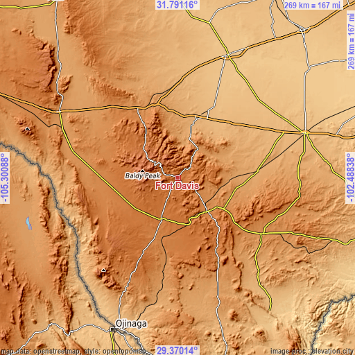
These maps also provides idea of topography and contour of this city, they are displayed at different zoom levels. More info about maps, scale and edge coordinates you can find below images.
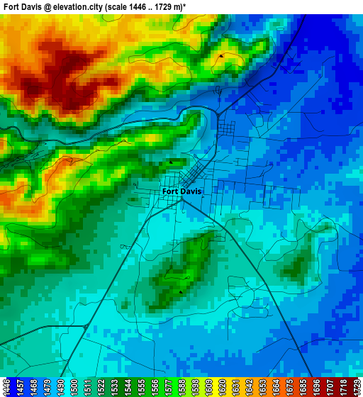
| \ | Map #1 | Topo.Map |
| Scale [m] | 1446..1729 m | × |
| Scale [ft] | 4744..5673 ft | × |
| Average | 1523.2 m = 4997 ft | × |
| Width | 8.41 km = 5.2 mi | 269.2 km = 167.3 mi |
| Height | 8.41 km = 5.2 mi | 269.2 km = 167.3 mi |
| ↑Max Latitude | 30.626033° | 31.79116° |
| Latitude at center | 30.58821° | 30.58821° |
| ↓Min Latitude | 30.550372° | 29.37014° |
| ← Min Longitude | -103.938575° | -105.30088° |
| Longitude center | -103.89463° | -103.89463° |
| →Max Longitude | -103.850685° | -102.48838° |
Nearby cities:
Cities around Fort Davis sort by population:
• Pecos elevation 791 m
100.4 km,  22°
22°
• Fort Stockton 904 m
102.8 km,  70°
70°
• Monahans 800 m
147 km,  40°
40°
• Kermit 875 m
160.4 km,  28°
28°
• Alpine 1367 m
33.9 km,  138°
138°
• Presidio 788 m
123.1 km,  201°
201°
• Van Horn 1233 m
102.6 km,  299°
299°
• Marfa 1430 m
33.3 km, 201°
• Wink 852 m
147 km, 28°
• Sanderson 849 m
152.3 km,  108°
108°
• Sierra Blanca 1382 m
154 km, 295°
• Mentone 825 m
127.3 km,  12°
12°
Multilingual:
 En español:
Fort Davis elevación 1494 m.
 En France:
Fort Davis élévation 1494 m.
 Auf Deutsch:
Fort Davis höhe über dem Meeresspiegel ist 1494 m.

Sources and notes:
- [note 1] Map square and city borders are not equal. Map elevation data is calculated only from area inside that square.
- [src 1] Elevation data from geonames database provided with same terms of usage.
- [src 2] The elevation map of Fort Davis is generated using elevation data from NASA's 3 arcsec (90m) resolution SRTM data.
- [src 3] Base (background) map © OpenStreetMap contributors tiles are generated by Geofabrik and OpenTopoMap.
Copyright & License:
This Fort Davis Elevation Map is licensed under CC BY-SA. You may reuse any part from this page, if you give a proper credit by linking to this URL:
 More info on terms of use page.