Mendota elevation
Mendota (California, Fresno County), United States elevation is 53 meters and Mendota elevation in feet is 174 ft above sea level [src 1]. Mendota is a populated place (feature code) with elevation that is 226 meters (741 ft) smaller than average city elevation in United States.
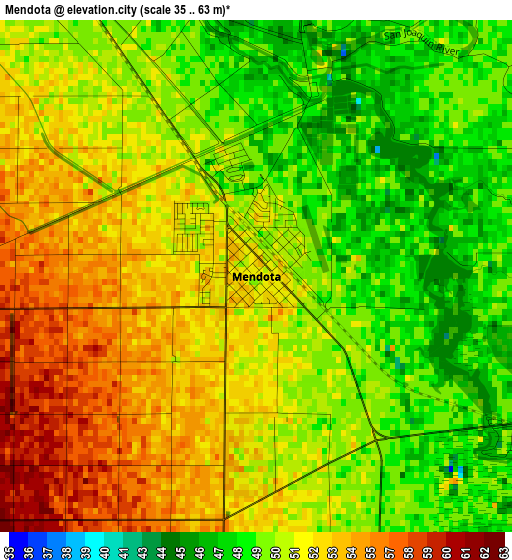
Below is the Elevation map of Mendota, which displays elevation range with different colors. Scale of the first map is from 35 to 63 m (115 to 207 ft) with average elevation of 51.1 meters (=168 ft) [note 1]
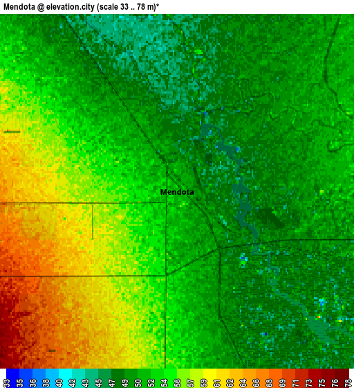
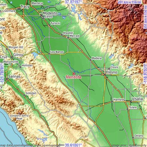
These maps also provides idea of topography and contour of this city, they are displayed at different zoom levels. More info about maps, scale and edge coordinates you can find below images.
| \ | Map #1 | Map #2 | Topo.Map |
| Scale [m] | 35..63 m | 33..78 m | × |
| Scale [ft] | 115..207 ft | 108..256 ft | × |
| Average | 51.1 m = 168 ft | 52.8 m = 173 ft | × |
| Width | 7.83 km = 4.9 mi | 15.66 km = 9.7 mi | 250.6 km = 155.7 mi |
| Height | 7.83 km = 4.9 mi | 15.66 km = 9.7 mi | 250.5 km = 155.7 mi |
| ↑Max Latitude | 36.788762° | 36.823947° | 37.87197° |
| Latitude at center | 36.75356° | 36.75356° | 36.75356° |
| ↓Min Latitude | 36.718342° | 36.683108° | 35.61861° |
| ← Min Longitude | -120.425505° | -120.469451° | -121.78781° |
| Longitude center | -120.38156° | -120.38156° | -120.38156° |
| →Max Longitude | -120.337615° | -120.293669° | -118.97531° |
Nearby cities:
Cities around Mendota sort by population:
• Madera elevation 87 m
36.7 km,  51°
51°
• Chowchilla 75 m
42.5 km,  14°
14°
• Kerman 72 m
28.9 km,  96°
96°
• Madera Acres 88 m
40.7 km,  43°
43°
• Firebaugh 46 m
13.5 km,  330°
330°
• Dos Palos 38 m
33.8 km,  319°
319°
• San Joaquin 56 m
23.7 km,  133°
133°
• Parksdale 86 m
38.5 km,  55°
55°
• Parkwood 83 m
35.6 km, 57°
• Biola 79 m
33 km,  80°
80°
• South Dos Palos 33 m
33.7 km,  314°
314°
• Fairmead 77 m
39.6 km,  25°
25°
Multilingual:
 En español:
Mendota elevación 53 m.
 En France:
Mendota élévation 53 m.


Sources and notes:
- [note 1] Map square and city borders are not equal. Map elevation data is calculated only from area inside that square.
- [src 1] Elevation data from geonames database provided with same terms of usage.
- [src 2] The elevation map of Mendota is generated using elevation data from NASA's 3 arcsec (90m) resolution SRTM data.
- [src 3] Base (background) map © OpenStreetMap contributors tiles are generated by Geofabrik and OpenTopoMap.
Copyright & License:
This Mendota Elevation Map is licensed under CC BY-SA. You may reuse any part from this page, if you give a proper credit by linking to this URL:
 More info on terms of use page.