Mariposa elevation
Mariposa (California, Mariposa County), United States elevation is 590 meters and Mariposa elevation in feet is 1936 ft above sea level [src 1]. Mariposa is a seat of a second-order administrative division (feature code) with elevation that is 311 meters (1020 ft) bigger than average city elevation in United States.
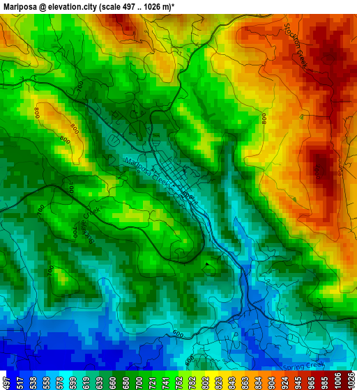
Below is the Elevation map of Mariposa, which displays elevation range with different colors. Scale of the first map is from 497 to 1026 m (1631 to 3366 ft) with average elevation of 719 meters (=2359 ft) [note 1]
These maps also provides idea of topography and contour of this city, they are displayed at different zoom levels. More info about maps, scale and edge coordinates you can find below images.
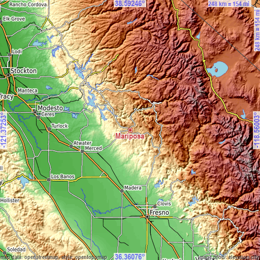
| \ | Map #1 | Topo.Map |
| Scale [m] | 497..1026 m | × |
| Scale [ft] | 1631..3366 ft | × |
| Average | 719 m = 2359 ft | × |
| Width | 7.75 km = 4.8 mi | 248.1 km = 154.2 mi |
| Height | 7.75 km = 4.8 mi | 248.1 km = 154.2 mi |
| ↑Max Latitude | 37.519803° | 38.59246° |
| Latitude at center | 37.48494° | 37.48494° |
| ↓Min Latitude | 37.450061° | 36.36076° |
| ← Min Longitude | -120.010225° | -121.37253° |
| Longitude center | -119.96628° | -119.96628° |
| →Max Longitude | -119.922335° | -118.56003° |
Nearby cities:
Cities around Mariposa sort by population:
• Merced elevation 56 m
50 km,  245°
245°
• Chowchilla 75 m
47.9 km,  212°
212°
• Madera Acres 88 m
52.6 km,  189°
189°
• Yosemite Lakes 393 m
36.9 km,  152°
152°
• Planada 72 m
37.9 km,  235°
235°
• Oakhurst 697 m
33 km,  121°
121°
• Ahwahnee 720 m
25 km, 122°
• Coarsegold 681 m
34.1 km,  136°
136°
• Le Grand 81 m
37.9 km,  221°
221°
• Fairmead 77 m
49.7 km,  203°
203°
• Midpines 799 m
7.7 km,  31°
31°
• Yosemite Valley 1227 m
44.5 km,  50°
50°
Multilingual:
 En español:
Mariposa elevación 590 m.
 En France:
Mariposa élévation 590 m.
 Auf Deutsch:
Mariposa höhe über dem Meeresspiegel ist 590 m.

Sources and notes:
- [note 1] Map square and city borders are not equal. Map elevation data is calculated only from area inside that square.
- [src 1] Elevation data from geonames database provided with same terms of usage.
- [src 2] The elevation map of Mariposa is generated using elevation data from NASA's 3 arcsec (90m) resolution SRTM data.
- [src 3] Base (background) map © OpenStreetMap contributors tiles are generated by Geofabrik and OpenTopoMap.
Copyright & License:
This Mariposa Elevation Map is licensed under CC BY-SA. You may reuse any part from this page, if you give a proper credit by linking to this URL:
 More info on terms of use page.