Fennimore elevation
Fennimore (Wisconsin, Grant County), United States elevation is 365 meters and Fennimore elevation in feet is 1198 ft above sea level [src 1]. Fennimore is a populated place (feature code) with elevation that is 86 meters (282 ft) bigger than average city elevation in United States.
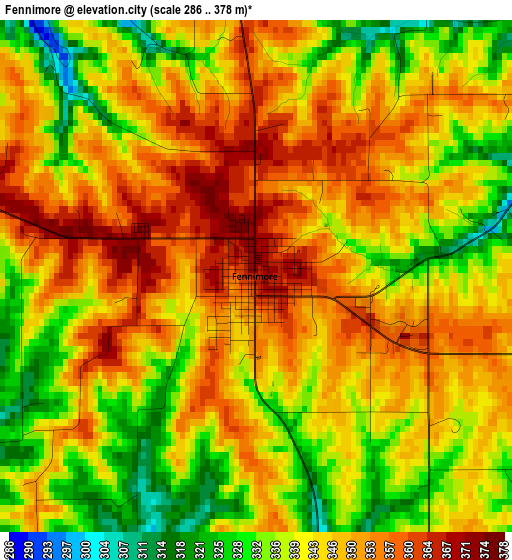
Below is the Elevation map of Fennimore, which displays elevation range with different colors. Scale of the first map is from 286 to 378 m (938 to 1240 ft) with average elevation of 343.9 meters (=1128 ft) [note 1]
These maps also provides idea of topography and contour of this city, they are displayed at different zoom levels. More info about maps, scale and edge coordinates you can find below images.
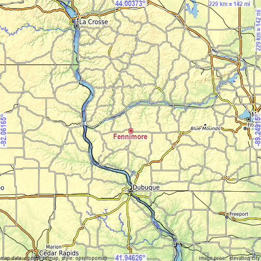
| \ | Map #1 | Topo.Map |
| Scale [m] | 286..378 m | × |
| Scale [ft] | 938..1240 ft | × |
| Average | 343.9 m = 1128 ft | × |
| Width | 7.15 km = 4.4 mi | 228.8 km = 142.2 mi |
| Height | 7.15 km = 4.4 mi | 228.8 km = 142.2 mi |
| ↑Max Latitude | 43.01574° | 44.00373° |
| Latitude at center | 42.9836° | 42.9836° |
| ↓Min Latitude | 42.951443° | 41.94626° |
| ← Min Longitude | -90.699345° | -92.06165° |
| Longitude center | -90.6554° | -90.6554° |
| →Max Longitude | -90.611455° | -89.24915° |
Nearby cities:
Cities around Fennimore sort by population:
• Platteville elevation 300 m
31.3 km,  152°
152°
• Prairie du Chien 197 m
40.2 km,  280°
280°
• Richland Center 227 m
44.7 km,  29°
29°
• Dodgeville 369 m
42.8 km,  93°
93°
• Lancaster 337 m
15.8 km,  196°
196°
• Boscobel 207 m
17.3 km,  346°
346°
• Mineral Point 318 m
41.1 km,  109°
109°
• Cuba City 309 m
45.9 km,  156°
156°
• Guttenberg 194 m
42.3 km,  238°
238°
• Spring Green 223 m
52.3 km,  65°
65°
• Muscoda 211 m
28.3 km,  37°
37°
• Dickeyville 291 m
40 km,  172°
172°
Multilingual:
 En español:
Fennimore elevación 365 m.
 En France:
Fennimore élévation 365 m.
 Auf Deutsch:
Fennimore höhe über dem Meeresspiegel ist 365 m.

Sources and notes:
- [note 1] Map square and city borders are not equal. Map elevation data is calculated only from area inside that square.
- [src 1] Elevation data from geonames database provided with same terms of usage.
- [src 2] The elevation map of Fennimore is generated using elevation data from NASA's 3 arcsec (90m) resolution SRTM data.
- [src 3] Base (background) map © OpenStreetMap contributors tiles are generated by Geofabrik and OpenTopoMap.
Copyright & License:
This Fennimore Elevation Map is licensed under CC BY-SA. You may reuse any part from this page, if you give a proper credit by linking to this URL:
 More info on terms of use page.