Foster elevation
Foster (Rhode Island, Providence County), United States elevation is 223 meters and Foster elevation in feet is 732 ft above sea level [src 1]. Foster is a populated place (feature code) with elevation that is 56 meters (184 ft) smaller than average city elevation in United States.
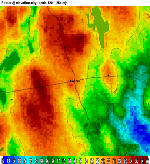
Below is the Elevation map of Foster, which displays elevation range with different colors. Scale of the first map is from 120 to 254 m (394 to 833 ft) with average elevation of 200.7 meters (=658 ft) [note 1]
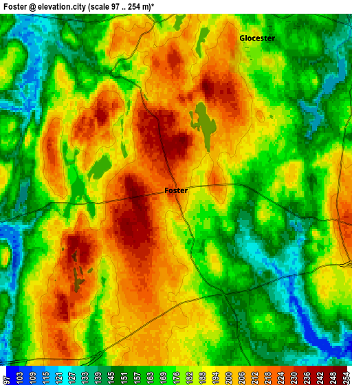
These maps also provides idea of topography and contour of this city, they are displayed at different zoom levels. More info about maps, scale and edge coordinates you can find below images.
| \ | Map #1 | Map #2 | Topo.Map |
| Scale [m] | 120..254 m | 97..254 m | × |
| Scale [ft] | 394..833 ft | 318..833 ft | × |
| Average | 200.7 m = 658 ft | 181.1 m = 594 ft | × |
| Width | 7.28 km = 4.5 mi | 14.56 km = 9 mi | 232.9 km = 144.7 mi |
| Height | 7.28 km = 4.5 mi | 14.56 km = 9 mi | 232.9 km = 144.7 mi |
| ↑Max Latitude | 41.886434° | 41.919142° | 42.89257° |
| Latitude at center | 41.85371° | 41.85371° | 41.85371° |
| ↓Min Latitude | 41.820969° | 41.788211° | 40.7977° |
| ← Min Longitude | -71.802065° | -71.846011° | -73.16437° |
| Longitude center | -71.75812° | -71.75812° | -71.75812° |
| →Max Longitude | -71.714175° | -71.670229° | -70.35187° |
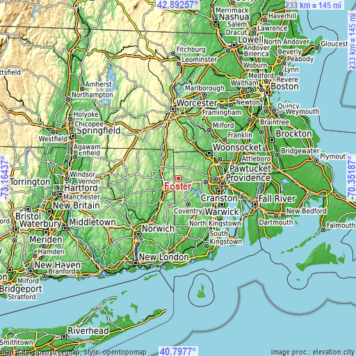
Nearby cities:
Cities around Foster sort by population:
• Coventry elevation 112 m
18.2 km,  159°
159°
• Killingly Center 104 m
9.4 km,  259°
259°
• North Scituate 95 m
14.4 km,  99°
99°
• Thompson 180 m
14.5 km,  323°
323°
• Greenville 89 m
17.2 km,  83°
83°
• Putnam 89 m
14.2 km,  298°
298°
• Pascoag 132 m
12.2 km,  22°
22°
• Danielson 66 m
12 km,  241°
241°
• Chepachet 132 m
9.9 km,  46°
46°
• East Brooklyn 86 m
13.2 km, 241°
• Harrisville 101 m
14.2 km,  29°
29°
• Wauregan 66 m
17.5 km,  225°
225°
Multilingual:
 En español:
Foster elevación 223 m.
 En France:
Foster élévation 223 m.


Sources and notes:
- [note 1] Map square and city borders are not equal. Map elevation data is calculated only from area inside that square.
- [src 1] Elevation data from geonames database provided with same terms of usage.
- [src 2] The elevation map of Foster is generated using elevation data from NASA's 3 arcsec (90m) resolution SRTM data.
- [src 3] Base (background) map © OpenStreetMap contributors tiles are generated by Geofabrik and OpenTopoMap.
Copyright & License:
This Foster Elevation Map is licensed under CC BY-SA. You may reuse any part from this page, if you give a proper credit by linking to this URL:
 More info on terms of use page.