Coventry elevation
Coventry (Rhode Island, Kent County), United States elevation is 112 meters and Coventry elevation in feet is 367 ft above sea level [src 1]. Coventry is a populated place (feature code) with elevation that is 167 meters (548 ft) smaller than average city elevation in United States.
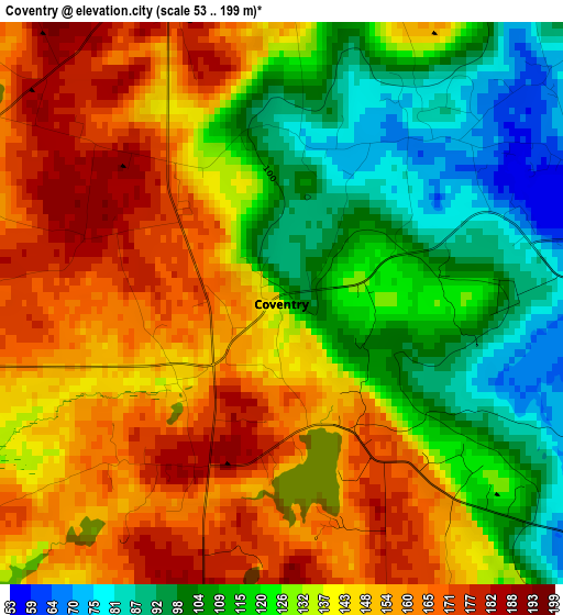
Below is the Elevation map of Coventry, which displays elevation range with different colors. Scale of the first map is from 53 to 199 m (174 to 653 ft) with average elevation of 135.1 meters (=443 ft) [note 1]
These maps also provides idea of topography and contour of this city, they are displayed at different zoom levels. More info about maps, scale and edge coordinates you can find below images.
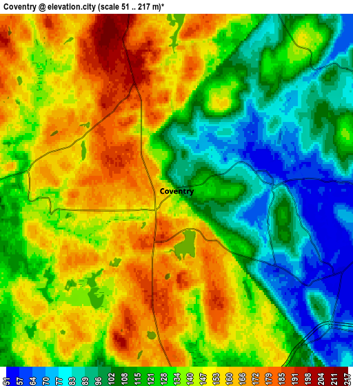
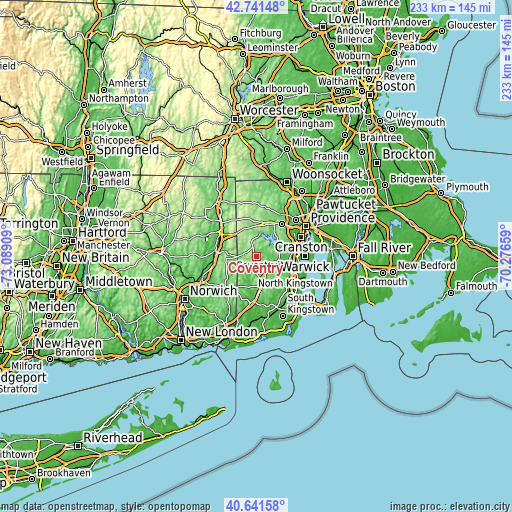
| \ | Map #1 | Map #2 | Topo.Map |
| Scale [m] | 53..199 m | 51..217 m | × |
| Scale [ft] | 174..653 ft | 167..712 ft | × |
| Average | 135.1 m = 443 ft | 131.3 m = 431 ft | × |
| Width | 7.3 km = 4.5 mi | 14.59 km = 9.1 mi | 233.5 km = 145.1 mi |
| Height | 7.3 km = 4.5 mi | 14.59 km = 9.1 mi | 233.5 km = 145.1 mi |
| ↑Max Latitude | 41.732903° | 41.765689° | 42.74148° |
| Latitude at center | 41.7001° | 41.7001° | 41.7001° |
| ↓Min Latitude | 41.66728° | 41.634444° | 40.64158° |
| ← Min Longitude | -71.726785° | -71.770731° | -73.08909° |
| Longitude center | -71.68284° | -71.68284° | -71.68284° |
| →Max Longitude | -71.638895° | -71.594949° | -70.27659° |
Nearby cities:
Cities around Coventry sort by population:
• West Warwick elevation 18 m
13.4 km,  91°
91°
• Johnston 25 m
19.9 km,  47°
47°
• Plainfield 63 m
19.5 km,  262°
262°
• East Greenwich 24 m
19.4 km,  103°
103°
• North Scituate 95 m
16.6 km,  28°
28°
• Exeter 61 m
18.2 km,  138°
138°
• West Greenwich 120 m
7.3 km,  164°
164°
• Foster 223 m
18.2 km,  339°
339°
• Danielson 66 m
20.3 km,  304°
304°
• Moosup 76 m
16.5 km,  274°
274°
• Plainfield Village 60 m
20.3 km, 262°
• Wauregan 66 m
19.4 km,  284°
284°
Multilingual:
 En español:
Coventry elevación 112 m.
 En France:
Coventry élévation 112 m.
 Auf Deutsch:
Coventry höhe über dem Meeresspiegel ist 112 m.

Sources and notes:
- [note 1] Map square and city borders are not equal. Map elevation data is calculated only from area inside that square.
- [src 1] Elevation data from geonames database provided with same terms of usage.
- [src 2] The elevation map of Coventry is generated using elevation data from NASA's 3 arcsec (90m) resolution SRTM data.
- [src 3] Base (background) map © OpenStreetMap contributors tiles are generated by Geofabrik and OpenTopoMap.
Copyright & License:
This Coventry Elevation Map is licensed under CC BY-SA. You may reuse any part from this page, if you give a proper credit by linking to this URL:
 More info on terms of use page.