Greenville elevation
Greenville (Rhode Island, Providence County), United States elevation is 89 meters and Greenville elevation in feet is 292 ft above sea level [src 1]. Greenville is a populated place (feature code) with elevation that is 190 meters (623 ft) smaller than average city elevation in United States.
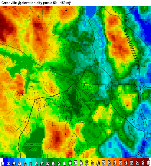
Below is the Elevation map of Greenville, which displays elevation range with different colors. Scale of the first map is from 50 to 159 m (164 to 522 ft) with average elevation of 100.3 meters (=329 ft) [note 1]
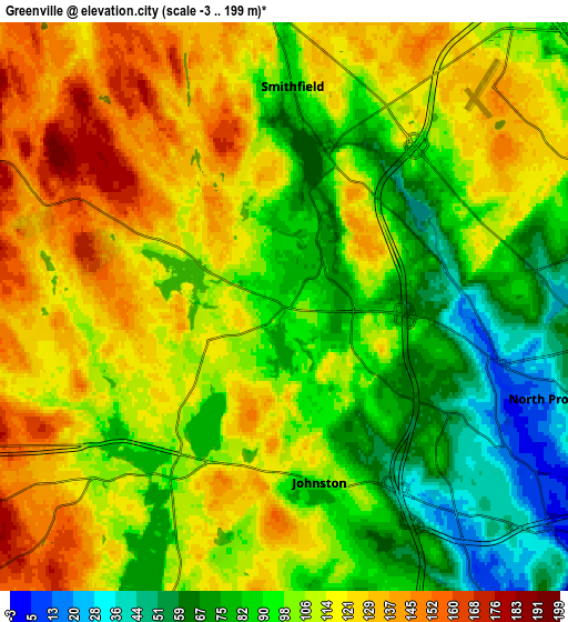
These maps also provides idea of topography and contour of this city, they are displayed at different zoom levels. More info about maps, scale and edge coordinates you can find below images.
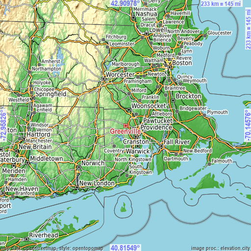
| \ | Map #1 | Map #2 | Topo.Map |
| Scale [m] | 50..159 m | -3..199 m | × |
| Scale [ft] | 164..522 ft | -10..653 ft | × |
| Average | 100.3 m = 329 ft | 104.4 m = 343 ft | × |
| Width | 7.28 km = 4.5 mi | 14.55 km = 9 mi | 232.9 km = 144.7 mi |
| Height | 7.28 km = 4.5 mi | 14.55 km = 9 mi | 232.9 km = 144.7 mi |
| ↑Max Latitude | 41.903925° | 41.936624° | 42.90978° |
| Latitude at center | 41.87121° | 41.87121° | 41.87121° |
| ↓Min Latitude | 41.838478° | 41.805729° | 40.81549° |
| ← Min Longitude | -71.595955° | -71.639901° | -72.95826° |
| Longitude center | -71.55201° | -71.55201° | -71.55201° |
| →Max Longitude | -71.508065° | -71.464119° | -70.14576° |
Nearby cities:
Cities around Greenville sort by population:
• Providence elevation -17 m
12.7 km,  114°
114°
• Cranston -1 m
13.9 km,  136°
136°
• North Providence 39 m
7.5 km, 108°
• Johnston 25 m
6.6 km,  145°
145°
• Smithfield 82 m
5.7 km,  2°
2°
• Lincoln 42 m
11.2 km,  60°
60°
• Central Falls 4 m
13.4 km,  80°
80°
• Valley Falls 8 m
13.9 km,  73°
73°
• North Smithfield 105 m
10.6 km, 1°
• North Scituate 95 m
5.3 km,  213°
213°
• Cumberland Hill 70 m
13.5 km,  31°
31°
• Chepachet 132 m
11 km,  296°
296°
Multilingual:
 En español:
Greenville elevación 89 m.
 En France:
Greenville élévation 89 m.
 Auf Deutsch:
Greenville höhe über dem Meeresspiegel ist 89 m.

Sources and notes:
- [note 1] Map square and city borders are not equal. Map elevation data is calculated only from area inside that square.
- [src 1] Elevation data from geonames database provided with same terms of usage.
- [src 2] The elevation map of Greenville is generated using elevation data from NASA's 3 arcsec (90m) resolution SRTM data.
- [src 3] Base (background) map © OpenStreetMap contributors tiles are generated by Geofabrik and OpenTopoMap.
Copyright & License:
This Greenville Elevation Map is licensed under CC BY-SA. You may reuse any part from this page, if you give a proper credit by linking to this URL:
 More info on terms of use page.