Mechanicsville elevation
Mechanicsville (Pennsylvania, Montour County), United States elevation is 181 meters and Mechanicsville elevation in feet is 594 ft above sea level [src 1]. Mechanicsville is a populated place (feature code) with elevation that is 98 meters (322 ft) smaller than average city elevation in United States.
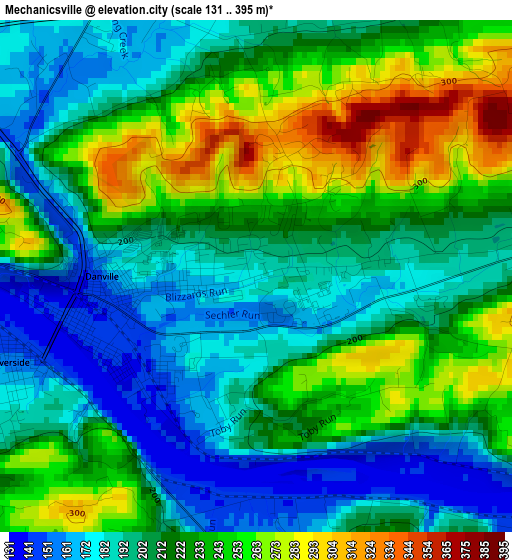
Below is the Elevation map of Mechanicsville, which displays elevation range with different colors. Scale of the first map is from 131 to 395 m (430 to 1296 ft) with average elevation of 217.2 meters (=713 ft) [note 1]
These maps also provides idea of topography and contour of this city, they are displayed at different zoom levels. More info about maps, scale and edge coordinates you can find below images.
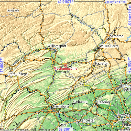
| \ | Map #1 | Topo.Map |
| Scale [m] | 131..395 m | × |
| Scale [ft] | 430..1296 ft | × |
| Average | 217.2 m = 713 ft | × |
| Width | 7.38 km = 4.6 mi | 236.1 km = 146.7 mi |
| Height | 7.38 km = 4.6 mi | 236.1 km = 146.7 mi |
| ↑Max Latitude | 40.999654° | 42.01977° |
| Latitude at center | 40.96648° | 40.96648° |
| ↓Min Latitude | 40.933289° | 39.8961° |
| ← Min Longitude | -76.630565° | -77.99287° |
| Longitude center | -76.58662° | -76.58662° |
| →Max Longitude | -76.542675° | -75.18037° |
Nearby cities:
Cities around Mechanicsville sort by population:
• Bloomsburg elevation 165 m
11.8 km,  69°
69°
• Shamokin 219 m
19.9 km,  173°
173°
• Danville 146 m
2.2 km,  261°
261°
• Northumberland 152 m
19.6 km,  244°
244°
• Edgewood 243 m
19.8 km,  176°
176°
• Elysburg 180 m
11.7 km, 165°
• Riverside 158 m
3.8 km,  250°
250°
• Espy 150 m
15.5 km, 73°
• Catawissa 160 m
10.8 km,  98°
98°
• Marshallton 269 m
20.4 km, 168°
• Light Street 167 m
15.7 km,  60°
60°
• Almedia 152 m
18.1 km, 72°
Multilingual:
 En español:
Mechanicsville elevación 181 m.
 En France:
Mechanicsville élévation 181 m.
 Auf Deutsch:
Mechanicsville höhe über dem Meeresspiegel ist 181 m.

Sources and notes:
- [note 1] Map square and city borders are not equal. Map elevation data is calculated only from area inside that square.
- [src 1] Elevation data from geonames database provided with same terms of usage.
- [src 2] The elevation map of Mechanicsville is generated using elevation data from NASA's 3 arcsec (90m) resolution SRTM data.
- [src 3] Base (background) map © OpenStreetMap contributors tiles are generated by Geofabrik and OpenTopoMap.
Copyright & License:
This Mechanicsville Elevation Map is licensed under CC BY-SA. You may reuse any part from this page, if you give a proper credit by linking to this URL:
 More info on terms of use page.