Struthers elevation
Struthers (Ohio, Mahoning County), United States elevation is 307 meters and Struthers elevation in feet is 1007 ft above sea level [src 1]. Struthers is a populated place (feature code) with elevation that is 28 meters (92 ft) bigger than average city elevation in United States.
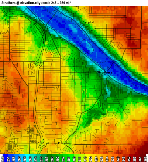
Below is the Elevation map of Struthers, which displays elevation range with different colors. Scale of the first map is from 246 to 366 m (807 to 1201 ft) with average elevation of 313.4 meters (=1028 ft) [note 1]
These maps also provides idea of topography and contour of this city, they are displayed at different zoom levels. More info about maps, scale and edge coordinates you can find below images.

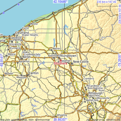
| \ | Map #1 | Map #2 | Topo.Map |
| Scale [m] | 246..366 m | 243..390 m | × |
| Scale [ft] | 807..1201 ft | 797..1280 ft | × |
| Average | 313.4 m = 1028 ft | 323.4 m = 1061 ft | × |
| Width | 7.37 km = 4.6 mi | 14.74 km = 9.2 mi | 235.8 km = 146.5 mi |
| Height | 7.37 km = 4.6 mi | 14.74 km = 9.2 mi | 235.8 km = 146.5 mi |
| ↑Max Latitude | 41.085691° | 41.118806° | 42.10446° |
| Latitude at center | 41.05256° | 41.05256° | 41.05256° |
| ↓Min Latitude | 41.019412° | 40.986248° | 39.98357° |
| ← Min Longitude | -80.651795° | -80.695741° | -82.0141° |
| Longitude center | -80.60785° | -80.60785° | -80.60785° |
| →Max Longitude | -80.563905° | -80.519959° | -79.2016° |
Nearby cities:
Cities around Struthers sort by population:
• Youngstown elevation 267 m
6.3 km,  326°
326°
• Boardman 336 m
5.6 km,  235°
235°
• Austintown 345 m
14.2 km,  292°
292°
• Girard 277 m
13.7 km, 325°
• Campbell 316 m
3 km,  14°
14°
• Hubbard 299 m
12 km,  15°
15°
• Canfield 353 m
13.2 km,  256°
256°
• Poland 316 m
3.2 km,  190°
190°
• Churchill 325 m
13.1 km,  338°
338°
• New Middletown 381 m
11 km,  157°
157°
• Lowellville 252 m
6.3 km,  107°
107°
• Bessemer 331 m
12.9 km,  132°
132°
Multilingual:
 En español:
Struthers elevación 307 m.
 En France:
Struthers élévation 307 m.
 Auf Deutsch:
Struthers höhe über dem Meeresspiegel ist 307 m.

Sources and notes:
- [note 1] Map square and city borders are not equal. Map elevation data is calculated only from area inside that square.
- [src 1] Elevation data from geonames database provided with same terms of usage.
- [src 2] The elevation map of Struthers is generated using elevation data from NASA's 3 arcsec (90m) resolution SRTM data.
- [src 3] Base (background) map © OpenStreetMap contributors tiles are generated by Geofabrik and OpenTopoMap.
Copyright & License:
This Struthers Elevation Map is licensed under CC BY-SA. You may reuse any part from this page, if you give a proper credit by linking to this URL:
 More info on terms of use page.