Ravenna elevation
Ravenna (Ohio, Portage County), United States elevation is 345 meters and Ravenna elevation in feet is 1132 ft above sea level [src 1]. Ravenna is a seat of a second-order administrative division (feature code) with elevation that is 66 meters (217 ft) bigger than average city elevation in United States.
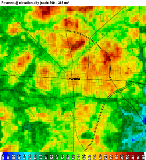
Below is the Elevation map of Ravenna, which displays elevation range with different colors. Scale of the first map is from 300 to 366 m (984 to 1201 ft) with average elevation of 335 meters (=1099 ft) [note 1]
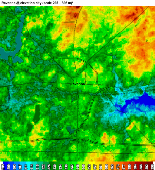
These maps also provides idea of topography and contour of this city, they are displayed at different zoom levels. More info about maps, scale and edge coordinates you can find below images.
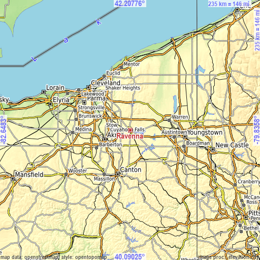
| \ | Map #1 | Map #2 | Topo.Map |
| Scale [m] | 300..366 m | 295..396 m | × |
| Scale [ft] | 984..1201 ft | 968..1299 ft | × |
| Average | 335 m = 1099 ft | 338.7 m = 1111 ft | × |
| Width | 7.36 km = 4.6 mi | 14.72 km = 9.1 mi | 235.4 km = 146.3 mi |
| Height | 7.36 km = 4.6 mi | 14.72 km = 9.1 mi | 235.4 km = 146.3 mi |
| ↑Max Latitude | 41.190638° | 41.2237° | 42.20776° |
| Latitude at center | 41.15756° | 41.15756° | 41.15756° |
| ↓Min Latitude | 41.124465° | 41.091354° | 40.09025° |
| ← Min Longitude | -81.285995° | -81.329941° | -82.6483° |
| Longitude center | -81.24205° | -81.24205° | -81.24205° |
| →Max Longitude | -81.198105° | -81.154159° | -79.8358° |
Nearby cities:
Cities around Ravenna sort by population:
• Stow elevation 331 m
16.6 km,  270°
270°
• Kent 327 m
9.7 km, 267°
• Hudson 327 m
19 km,  298°
298°
• Tallmadge 343 m
17.9 km,  249°
249°
• Streetsboro 343 m
12.6 km,  316°
316°
• Munroe Falls 311 m
16.6 km,  264°
264°
• Mogadore 351 m
18 km,  226°
226°
• Brimfield 334 m
10.8 km, 233°
• Silver Lake 326 m
17.8 km, 270°
• Garrettsville 304 m
18.6 km,  40°
40°
• Windham 299 m
18.3 km,  61°
61°
• Mantua 355 m
14.1 km,  6°
6°
Multilingual:
 En español:
Ravenna elevación 345 m.
 En France:
Ravenna élévation 345 m.


Sources and notes:
- [note 1] Map square and city borders are not equal. Map elevation data is calculated only from area inside that square.
- [src 1] Elevation data from geonames database provided with same terms of usage.
- [src 2] The elevation map of Ravenna is generated using elevation data from NASA's 3 arcsec (90m) resolution SRTM data.
- [src 3] Base (background) map © OpenStreetMap contributors tiles are generated by Geofabrik and OpenTopoMap.
Copyright & License:
This Ravenna Elevation Map is licensed under CC BY-SA. You may reuse any part from this page, if you give a proper credit by linking to this URL:
 More info on terms of use page.