Mogadore elevation
Mogadore (Ohio, Summit County), United States elevation is 351 meters and Mogadore elevation in feet is 1152 ft above sea level [src 1]. Mogadore is a populated place (feature code) with elevation that is 72 meters (236 ft) bigger than average city elevation in United States.
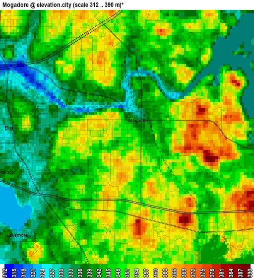
Below is the Elevation map of Mogadore, which displays elevation range with different colors. Scale of the first map is from 312 to 390 m (1024 to 1280 ft) with average elevation of 346.9 meters (=1138 ft) [note 1]
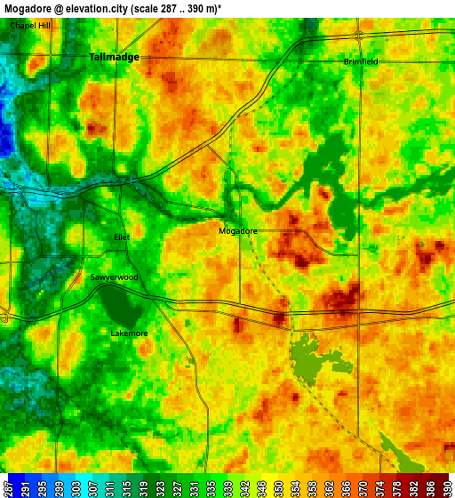
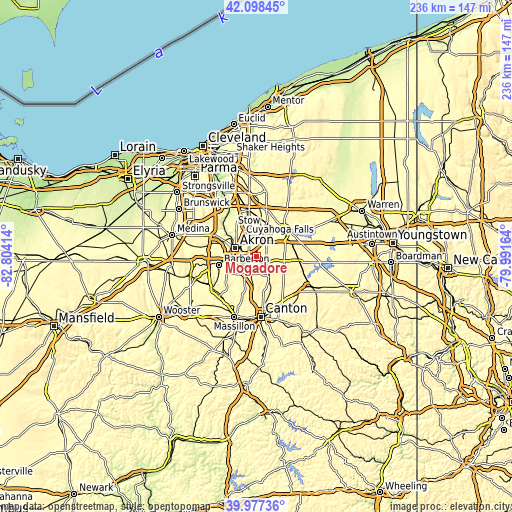
These maps also provides idea of topography and contour of this city, they are displayed at different zoom levels. More info about maps, scale and edge coordinates you can find below images.
| \ | Map #1 | Map #2 | Topo.Map |
| Scale [m] | 312..390 m | 287..390 m | × |
| Scale [ft] | 1024..1280 ft | 942..1280 ft | × |
| Average | 346.9 m = 1138 ft | 343.8 m = 1128 ft | × |
| Width | 7.37 km = 4.6 mi | 14.74 km = 9.2 mi | 235.8 km = 146.5 mi |
| Height | 7.37 km = 4.6 mi | 14.74 km = 9.2 mi | 235.8 km = 146.5 mi |
| ↑Max Latitude | 41.079584° | 41.112702° | 42.09845° |
| Latitude at center | 41.04645° | 41.04645° | 41.04645° |
| ↓Min Latitude | 41.013299° | 40.980131° | 39.97736° |
| ← Min Longitude | -81.441835° | -81.485781° | -82.80414° |
| Longitude center | -81.39789° | -81.39789° | -81.39789° |
| →Max Longitude | -81.353945° | -81.309999° | -79.99164° |
Nearby cities:
Cities around Mogadore sort by population:
• Akron elevation 295 m
10.9 km,  290°
290°
• Cuyahoga Falls 310 m
12.1 km,  323°
323°
• Stow 331 m
13.1 km,  344°
344°
• Kent 327 m
12.4 km,  15°
15°
• Tallmadge 343 m
7.1 km,  328°
328°
• Portage Lakes 330 m
11.7 km,  248°
248°
• Munroe Falls 311 m
11.5 km, 342°
• Brimfield 334 m
7.4 km,  35°
35°
• Uniontown 347 m
8 km,  186°
186°
• Lakemore 328 m
4.3 km,  228°
228°
• Hartville 354 m
10.8 km,  148°
148°
• Sawyerwood 336 m
3.7 km,  255°
255°
Multilingual:
 En español:
Mogadore elevación 351 m.
 En France:
Mogadore élévation 351 m.
 Auf Deutsch:
Mogadore höhe über dem Meeresspiegel ist 351 m.

Sources and notes:
- [note 1] Map square and city borders are not equal. Map elevation data is calculated only from area inside that square.
- [src 1] Elevation data from geonames database provided with same terms of usage.
- [src 2] The elevation map of Mogadore is generated using elevation data from NASA's 3 arcsec (90m) resolution SRTM data.
- [src 3] Base (background) map © OpenStreetMap contributors tiles are generated by Geofabrik and OpenTopoMap.
Copyright & License:
This Mogadore Elevation Map is licensed under CC BY-SA. You may reuse any part from this page, if you give a proper credit by linking to this URL:
 More info on terms of use page.