Mantua elevation
Mantua (Ohio, Portage County), United States elevation is 355 meters and Mantua elevation in feet is 1165 ft above sea level [src 1]. Mantua is a populated place (feature code) with elevation that is 76 meters (249 ft) bigger than average city elevation in United States.
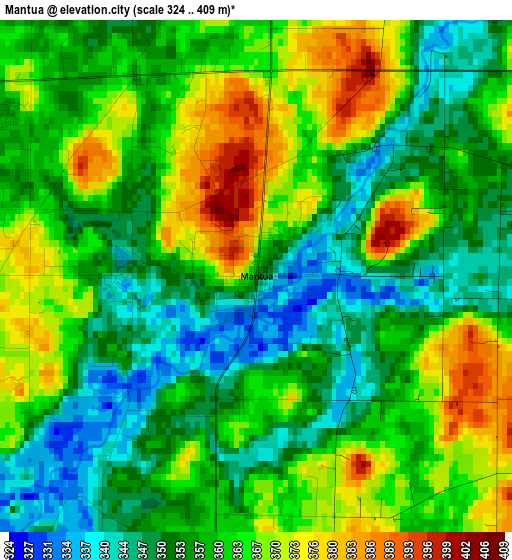
Below is the Elevation map of Mantua, which displays elevation range with different colors. Scale of the first map is from 324 to 409 m (1063 to 1342 ft) with average elevation of 359.6 meters (=1180 ft) [note 1]
These maps also provides idea of topography and contour of this city, they are displayed at different zoom levels. More info about maps, scale and edge coordinates you can find below images.
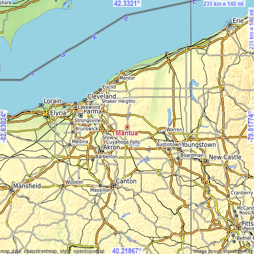
| \ | Map #1 | Topo.Map |
| Scale [m] | 324..409 m | × |
| Scale [ft] | 1063..1342 ft | × |
| Average | 359.6 m = 1180 ft | × |
| Width | 7.34 km = 4.6 mi | 235 km = 146 mi |
| Height | 7.34 km = 4.6 mi | 235 km = 146 mi |
| ↑Max Latitude | 41.316954° | 42.3321° |
| Latitude at center | 41.28394° | 41.28394° |
| ↓Min Latitude | 41.250909° | 40.21867° |
| ← Min Longitude | -81.267935° | -82.63024° |
| Longitude center | -81.22399° | -81.22399° |
| →Max Longitude | -81.180045° | -79.81774° |
Nearby cities:
Cities around Mantua sort by population:
• Kent elevation 327 m
18.3 km,  217°
217°
• Hudson 327 m
18.8 km,  254°
254°
• Twinsburg 304 m
18.3 km,  279°
279°
• Streetsboro 343 m
11.3 km,  243°
243°
• Aurora 342 m
10.8 km,  290°
290°
• Ravenna 345 m
14.1 km,  186°
186°
• Reminderville 310 m
15.9 km,  295°
295°
• South Russell 346 m
20.2 km,  324°
324°
• Bainbridge 358 m
14.9 km, 319°
• Garrettsville 304 m
10.7 km,  89°
89°
• Windham 299 m
15.6 km,  110°
110°
• Hiram 384 m
7.4 km,  64°
64°
Multilingual:
 En español:
Mantua elevación 355 m.
 En France:
Mantua élévation 355 m.


Sources and notes:
- [note 1] Map square and city borders are not equal. Map elevation data is calculated only from area inside that square.
- [src 1] Elevation data from geonames database provided with same terms of usage.
- [src 2] The elevation map of Mantua is generated using elevation data from NASA's 3 arcsec (90m) resolution SRTM data.
- [src 3] Base (background) map © OpenStreetMap contributors tiles are generated by Geofabrik and OpenTopoMap.
Copyright & License:
This Mantua Elevation Map is licensed under CC BY-SA. You may reuse any part from this page, if you give a proper credit by linking to this URL:
 More info on terms of use page.