Ashley elevation
Ashley (Ohio, Delaware County), United States elevation is 299 meters and Ashley elevation in feet is 981 ft above sea level [src 1]. Ashley is a populated place (feature code) with elevation that is 20 meters (66 ft) bigger than average city elevation in United States.
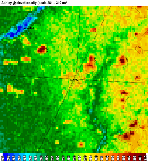
Below is the Elevation map of Ashley, which displays elevation range with different colors. Scale of the first map is from 281 to 310 m (922 to 1017 ft) with average elevation of 294.7 meters (=967 ft) [note 1]
These maps also provides idea of topography and contour of this city, they are displayed at different zoom levels. More info about maps, scale and edge coordinates you can find below images.
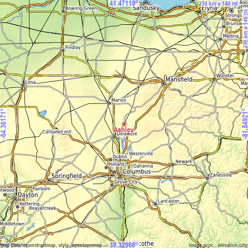
| \ | Map #1 | Topo.Map |
| Scale [m] | 281..310 m | × |
| Scale [ft] | 922..1017 ft | × |
| Average | 294.7 m = 967 ft | × |
| Width | 7.44 km = 4.6 mi | 238.1 km = 147.9 mi |
| Height | 7.44 km = 4.6 mi | 238.1 km = 147.9 mi |
| ↑Max Latitude | 40.442403° | 41.47119° |
| Latitude at center | 40.40895° | 40.40895° |
| ↓Min Latitude | 40.37548° | 39.32968° |
| ← Min Longitude | -82.999405° | -84.36171° |
| Longitude center | -82.95546° | -82.95546° |
| →Max Longitude | -82.911515° | -81.54921° |
Nearby cities:
Cities around Ashley sort by population:
• Westerville elevation 262 m
31.5 km,  175°
175°
• Delaware 262 m
15.5 km,  217°
217°
• Marion 301 m
24.8 km,  323°
323°
• Worthington 261 m
35.5 km,  188°
188°
• Powell 277 m
29.7 km,  199°
199°
• Lewis Center 285 m
23.9 km, 191°
• Sunbury 298 m
20.2 km,  156°
156°
• Mount Gilead 348 m
19 km,  34°
34°
• Richwood 288 m
29 km,  273°
273°
• Centerburg 374 m
24.8 km,  117°
117°
• Cardington 305 m
11.5 km, 27°
• Prospect 275 m
20.3 km,  283°
283°
Multilingual:
 En español:
Ashley elevación 299 m.
 En France:
Ashley élévation 299 m.


Sources and notes:
- [note 1] Map square and city borders are not equal. Map elevation data is calculated only from area inside that square.
- [src 1] Elevation data from geonames database provided with same terms of usage.
- [src 2] The elevation map of Ashley is generated using elevation data from NASA's 3 arcsec (90m) resolution SRTM data.
- [src 3] Base (background) map © OpenStreetMap contributors tiles are generated by Geofabrik and OpenTopoMap.
Copyright & License:
This Ashley Elevation Map is licensed under CC BY-SA. You may reuse any part from this page, if you give a proper credit by linking to this URL:
 More info on terms of use page.