Westerville elevation
Westerville (Ohio, Franklin County), United States elevation is 262 meters and Westerville elevation in feet is 860 ft above sea level [src 1]. Westerville is a populated place (feature code) with elevation that is 17 meters (56 ft) smaller than average city elevation in United States.
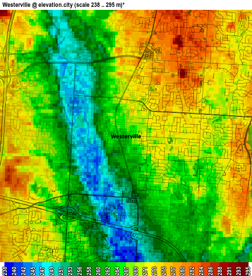
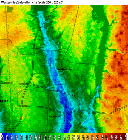
Below is the Elevation map of Westerville, which displays elevation range with different colors. Scale of the first map is from 238 to 295 m (781 to 968 ft) with average elevation of 266.3 meters (=874 ft) [note 1]
These maps also provides idea of topography and contour of this city, they are displayed at different zoom levels. More info about maps, scale and edge coordinates you can find below images.
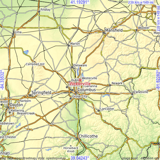
| \ | Map #1 | Map #2 | Topo.Map |
| Scale [m] | 238..295 m | 236..320 m | × |
| Scale [ft] | 781..968 ft | 774..1050 ft | × |
| Average | 266.3 m = 874 ft | 276.1 m = 906 ft | × |
| Width | 7.47 km = 4.6 mi | 14.94 km = 9.3 mi | 239.1 km = 148.6 mi |
| Height | 7.47 km = 4.6 mi | 14.94 km = 9.3 mi | 239.1 km = 148.6 mi |
| ↑Max Latitude | 40.159763° | 40.19334° | 41.19291° |
| Latitude at center | 40.12617° | 40.12617° | 40.12617° |
| ↓Min Latitude | 40.09256° | 40.058933° | 39.04243° |
| ← Min Longitude | -82.973015° | -83.016961° | -84.33532° |
| Longitude center | -82.92907° | -82.92907° | -82.92907° |
| →Max Longitude | -82.885125° | -82.841179° | -81.52282° |
Nearby cities:
Cities around Westerville sort by population:
• Dublin elevation 253 m
16 km,  259°
259°
• Upper Arlington 249 m
18.5 km,  217°
217°
• Gahanna 244 m
12.6 km,  160°
160°
• Whitehall 242 m
18.1 km,  168°
168°
• Worthington 261 m
8.4 km,  244°
244°
• Bexley 243 m
17.5 km,  182°
182°
• Powell 277 m
12.9 km,  285°
285°
• Lewis Center 285 m
10.6 km,  319°
319°
• New Albany 311 m
11.4 km,  116°
116°
• Sunbury 298 m
14.2 km,  24°
24°
• Huber Ridge 251 m
4.3 km, 165°
• Minerva Park 265 m
5.7 km,  192°
192°
Multilingual:
 En español:
Westerville elevación 262 m.
 En France:
Westerville élévation 262 m.
 Auf Deutsch:
Westerville höhe über dem Meeresspiegel ist 262 m.

Sources and notes:
- [note 1] Map square and city borders are not equal. Map elevation data is calculated only from area inside that square.
- [src 1] Elevation data from geonames database provided with same terms of usage.
- [src 2] The elevation map of Westerville is generated using elevation data from NASA's 3 arcsec (90m) resolution SRTM data.
- [src 3] Base (background) map © OpenStreetMap contributors tiles are generated by Geofabrik and OpenTopoMap.
Copyright & License:
This Westerville Elevation Map is licensed under CC BY-SA. You may reuse any part from this page, if you give a proper credit by linking to this URL:
 More info on terms of use page.