Cardington elevation
Cardington (Ohio, Morrow County), United States elevation is 305 meters and Cardington elevation in feet is 1001 ft above sea level [src 1]. Cardington is a populated place (feature code) with elevation that is 26 meters (85 ft) bigger than average city elevation in United States.
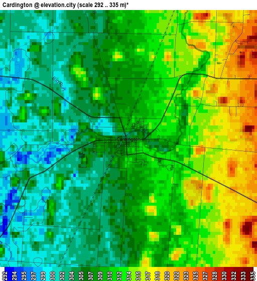
Below is the Elevation map of Cardington, which displays elevation range with different colors. Scale of the first map is from 292 to 335 m (958 to 1099 ft) with average elevation of 309.1 meters (=1014 ft) [note 1]
These maps also provides idea of topography and contour of this city, they are displayed at different zoom levels. More info about maps, scale and edge coordinates you can find below images.
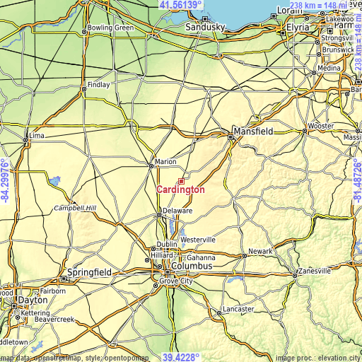
| \ | Map #1 | Topo.Map |
| Scale [m] | 292..335 m | × |
| Scale [ft] | 958..1099 ft | × |
| Average | 309.1 m = 1014 ft | × |
| Width | 7.43 km = 4.6 mi | 237.8 km = 147.8 mi |
| Height | 7.43 km = 4.6 mi | 237.8 km = 147.8 mi |
| ↑Max Latitude | 40.534028° | 41.56139° |
| Latitude at center | 40.50062° | 40.50062° |
| ↓Min Latitude | 40.467196° | 39.4228° |
| ← Min Longitude | -82.937455° | -84.29976° |
| Longitude center | -82.89351° | -82.89351° |
| →Max Longitude | -82.849565° | -81.48726° |
Nearby cities:
Cities around Cardington sort by population:
• Delaware elevation 262 m
26.9 km,  213°
213°
• Marion 301 m
22.1 km,  296°
296°
• Bucyrus 302 m
34.9 km,  348°
348°
• Galion 356 m
27.3 km,  18°
18°
• Sunbury 298 m
28.8 km,  174°
174°
• Lexington 371 m
32.9 km,  52°
52°
• Crestline 350 m
34.5 km, 22°
• Mount Gilead 348 m
7.8 km, 45°
• Fredericktown 340 m
29.9 km,  94°
94°
• Centerburg 374 m
27.5 km,  142°
142°
• Ashley 299 m
11.5 km, 207°
• Prospect 275 m
25.6 km,  257°
257°
Multilingual:
 En español:
Cardington elevación 305 m.
 En France:
Cardington élévation 305 m.
 Auf Deutsch:
Cardington höhe über dem Meeresspiegel ist 305 m.

Sources and notes:
- [note 1] Map square and city borders are not equal. Map elevation data is calculated only from area inside that square.
- [src 1] Elevation data from geonames database provided with same terms of usage.
- [src 2] The elevation map of Cardington is generated using elevation data from NASA's 3 arcsec (90m) resolution SRTM data.
- [src 3] Base (background) map © OpenStreetMap contributors tiles are generated by Geofabrik and OpenTopoMap.
Copyright & License:
This Cardington Elevation Map is licensed under CC BY-SA. You may reuse any part from this page, if you give a proper credit by linking to this URL:
 More info on terms of use page.