Lexington elevation
Lexington (Ohio, Richland County), United States elevation is 371 meters and Lexington elevation in feet is 1217 ft above sea level [src 1]. Lexington is a populated place (feature code) with elevation that is 92 meters (302 ft) bigger than average city elevation in United States.
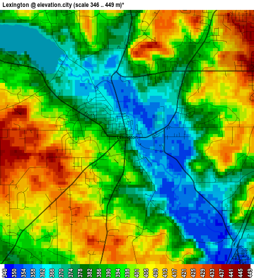
Below is the Elevation map of Lexington, which displays elevation range with different colors. Scale of the first map is from 346 to 449 m (1135 to 1473 ft) with average elevation of 391.8 meters (=1285 ft) [note 1]
These maps also provides idea of topography and contour of this city, they are displayed at different zoom levels. More info about maps, scale and edge coordinates you can find below images.
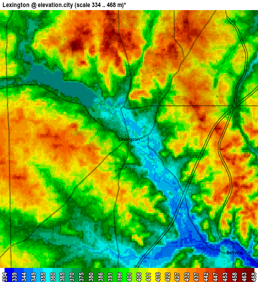
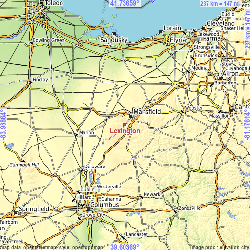
| \ | Map #1 | Map #2 | Topo.Map |
| Scale [m] | 346..449 m | 334..468 m | × |
| Scale [ft] | 1135..1473 ft | 1096..1535 ft | × |
| Average | 391.8 m = 1285 ft | 400.6 m = 1314 ft | × |
| Width | 7.41 km = 4.6 mi | 14.82 km = 9.2 mi | 237.2 km = 147.4 mi |
| Height | 7.41 km = 4.6 mi | 14.82 km = 9.2 mi | 237.2 km = 147.4 mi |
| ↑Max Latitude | 40.711989° | 40.745291° | 41.73659° |
| Latitude at center | 40.67867° | 40.67867° | 40.67867° |
| ↓Min Latitude | 40.645335° | 40.611982° | 39.60369° |
| ← Min Longitude | -82.626335° | -82.670281° | -83.98864° |
| Longitude center | -82.58239° | -82.58239° | -82.58239° |
| →Max Longitude | -82.538445° | -82.494499° | -81.17614° |
Nearby cities:
Cities around Lexington sort by population:
• Mansfield elevation 382 m
10.5 km,  32°
32°
• Ashland 325 m
30.7 km,  46°
46°
• Mount Vernon 311 m
32.8 km,  165°
165°
• Galion 356 m
18.5 km,  289°
289°
• Shelby 333 m
23.5 km,  343°
343°
• Ontario 413 m
9 km,  355°
355°
• Crestline 350 m
17.8 km,  312°
312°
• Lincoln Heights 398 m
13.2 km,  38°
38°
• Mount Gilead 348 m
25.2 km,  235°
235°
• Loudonville 297 m
29.8 km,  99°
99°
• Fredericktown 340 m
22.2 km, 170°
• Bellville 348 m
8.9 km,  137°
137°
Multilingual:
 En español:
Lexington elevación 371 m.
 En France:
Lexington élévation 371 m.
 Auf Deutsch:
Lexington höhe über dem Meeresspiegel ist 371 m.

Sources and notes:
- [note 1] Map square and city borders are not equal. Map elevation data is calculated only from area inside that square.
- [src 1] Elevation data from geonames database provided with same terms of usage.
- [src 2] The elevation map of Lexington is generated using elevation data from NASA's 3 arcsec (90m) resolution SRTM data.
- [src 3] Base (background) map © OpenStreetMap contributors tiles are generated by Geofabrik and OpenTopoMap.
Copyright & License:
This Lexington Elevation Map is licensed under CC BY-SA. You may reuse any part from this page, if you give a proper credit by linking to this URL:
 More info on terms of use page.