Blauvelt elevation
Blauvelt (New York, Rockland County), United States elevation is 66 meters and Blauvelt elevation in feet is 217 ft above sea level [src 1]. Blauvelt is a populated place (feature code) with elevation that is 213 meters (699 ft) smaller than average city elevation in United States.
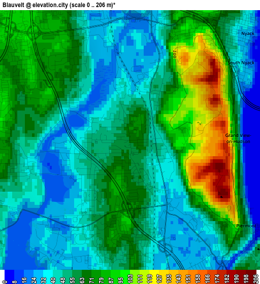
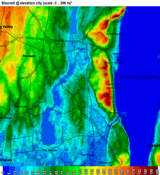
Below is the Elevation map of Blauvelt, which displays elevation range with different colors. Scale of the first map is from 0 to 206 m (0 to 676 ft) with average elevation of 58.4 meters (=192 ft) [note 1]
These maps also provides idea of topography and contour of this city, they are displayed at different zoom levels. More info about maps, scale and edge coordinates you can find below images.
| \ | Map #1 | Map #2 | Topo.Map |
| Scale [m] | 0..206 m | -3..206 m | × |
| Scale [ft] | 0..676 ft | -10..676 ft | × |
| Average | 58.4 m = 192 ft | 51.5 m = 169 ft | × |
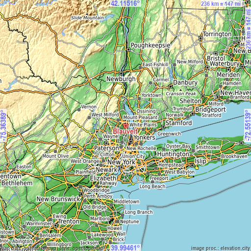
| Width | 7.37 km = 4.6 mi | 14.74 km = 9.2 mi | 235.8 km = 146.5 mi |
| Height | 7.37 km = 4.6 mi | 14.74 km = 9.2 mi | 235.8 km = 146.5 mi |
| ↑Max Latitude | 41.096556° | 41.129665° | 42.11516° |
| Latitude at center | 41.06343° | 41.06343° | 41.06343° |
| ↓Min Latitude | 41.030288° | 40.997129° | 39.99461° |
| ← Min Longitude | -74.001585° | -74.045531° | -75.36389° |
| Longitude center | -73.95764° | -73.95764° | -73.95764° |
| →Max Longitude | -73.913695° | -73.869749° | -72.55139° |
Nearby cities:
Cities around Blauvelt sort by population:
• Nanuet elevation 100 m
5.5 km,  300°
300°
• Pearl River 78 m
5.4 km,  264°
264°
• Valley Cottage 61 m
6.1 km,  1°
1°
• Montvale 100 m
5.8 km,  251°
251°
• Nyack 26 m
4.5 km,  47°
47°
• Tappan 17 m
4.7 km,  169°
169°
• Orangeburg 38 m
2 km,  160°
160°
• South Nyack 29 m
3.8 km,  55°
55°
• West Nyack 27 m
3.9 km,  340°
340°
• Piermont 46 m
4.1 km,  125°
125°
• Upper Nyack 62 m
5.8 km,  32°
32°
• Sparkill 18 m
4.4 km,  144°
144°
Multilingual:
 En español:
Blauvelt elevación 66 m.
 En France:
Blauvelt élévation 66 m.


Sources and notes:
- [note 1] Map square and city borders are not equal. Map elevation data is calculated only from area inside that square.
- [src 1] Elevation data from geonames database provided with same terms of usage.
- [src 2] The elevation map of Blauvelt is generated using elevation data from NASA's 3 arcsec (90m) resolution SRTM data.
- [src 3] Base (background) map © OpenStreetMap contributors tiles are generated by Geofabrik and OpenTopoMap.
Copyright & License:
This Blauvelt Elevation Map is licensed under CC BY-SA. You may reuse any part from this page, if you give a proper credit by linking to this URL:
 More info on terms of use page.