Nanuet elevation
Nanuet (New York, Rockland County), United States elevation is 100 meters and Nanuet elevation in feet is 328 ft above sea level [src 1]. Nanuet is a populated place (feature code) with elevation that is 179 meters (587 ft) smaller than average city elevation in United States.
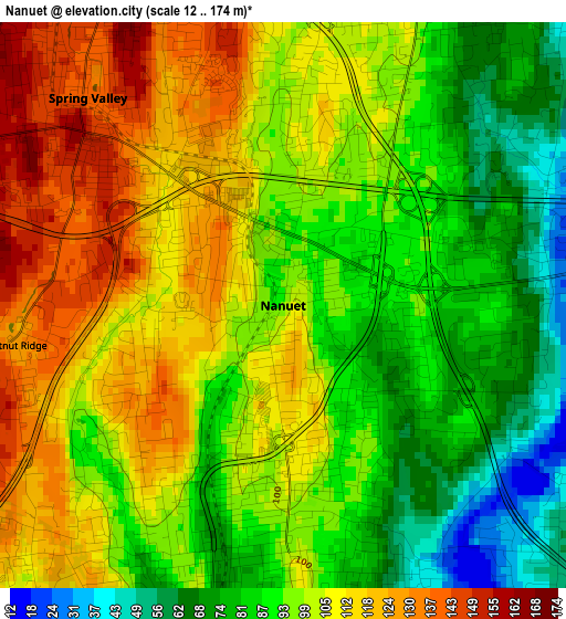
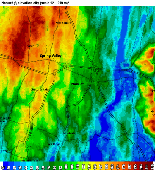
Below is the Elevation map of Nanuet, which displays elevation range with different colors. Scale of the first map is from 12 to 174 m (39 to 571 ft) with average elevation of 98.5 meters (=323 ft) [note 1]
These maps also provides idea of topography and contour of this city, they are displayed at different zoom levels. More info about maps, scale and edge coordinates you can find below images.
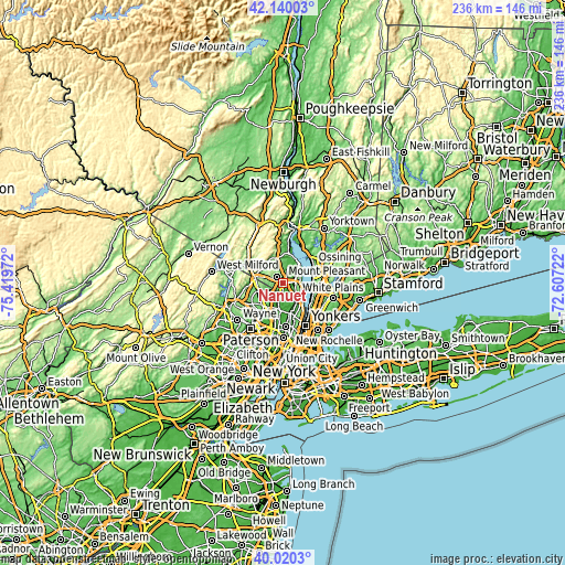
| \ | Map #1 | Map #2 | Topo.Map |
| Scale [m] | 12..174 m | 12..219 m | × |
| Scale [ft] | 39..571 ft | 39..719 ft | × |
| Average | 98.5 m = 323 ft | 97.2 m = 319 ft | × |
| Width | 7.37 km = 4.6 mi | 14.73 km = 9.2 mi | 235.7 km = 146.5 mi |
| Height | 7.37 km = 4.6 mi | 14.73 km = 9.2 mi | 235.7 km = 146.5 mi |
| ↑Max Latitude | 41.121823° | 41.154919° | 42.14003° |
| Latitude at center | 41.08871° | 41.08871° | 41.08871° |
| ↓Min Latitude | 41.05558° | 41.022434° | 40.0203° |
| ← Min Longitude | -74.057415° | -74.101361° | -75.41972° |
| Longitude center | -74.01347° | -74.01347° | -74.01347° |
| →Max Longitude | -73.969525° | -73.925579° | -72.60722° |
Nearby cities:
Cities around Nanuet sort by population:
• Spring Valley elevation 139 m
3.7 km,  316°
316°
• Monsey 167 m
5.2 km,  298°
298°
• Pearl River 78 m
3.4 km,  191°
191°
• Valley Cottage 61 m
5.9 km,  56°
56°
• Montvale 100 m
4.7 km, 189°
• Chestnut Ridge 127 m
3.6 km,  262°
262°
• New Square 152 m
5.8 km,  346°
346°
• Hillcrest 159 m
4.9 km,  332°
332°
• Blauvelt 66 m
5.5 km,  120°
120°
• Kaser 174 m
5.8 km,  308°
308°
• Bardonia 96 m
2.7 km,  31°
31°
• West Nyack 27 m
3.5 km,  75°
75°
Multilingual:
 En español:
Nanuet elevación 100 m.
 En France:
Nanuet élévation 100 m.


Sources and notes:
- [note 1] Map square and city borders are not equal. Map elevation data is calculated only from area inside that square.
- [src 1] Elevation data from geonames database provided with same terms of usage.
- [src 2] The elevation map of Nanuet is generated using elevation data from NASA's 3 arcsec (90m) resolution SRTM data.
- [src 3] Base (background) map © OpenStreetMap contributors tiles are generated by Geofabrik and OpenTopoMap.
Copyright & License:
This Nanuet Elevation Map is licensed under CC BY-SA. You may reuse any part from this page, if you give a proper credit by linking to this URL:
 More info on terms of use page.