Strafford elevation
Strafford (New Hampshire, Strafford County), United States elevation is 200 meters and Strafford elevation in feet is 656 ft above sea level [src 1]. Strafford is a populated place (feature code) with elevation that is 79 meters (259 ft) smaller than average city elevation in United States.
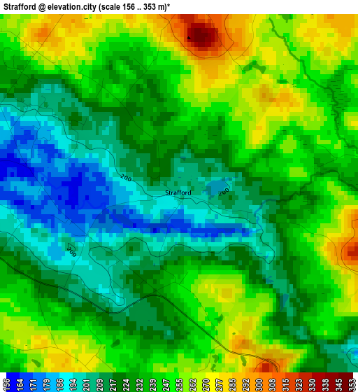
Below is the Elevation map of Strafford, which displays elevation range with different colors. Scale of the first map is from 156 to 353 m (512 to 1158 ft) with average elevation of 234 meters (=768 ft) [note 1]
These maps also provides idea of topography and contour of this city, they are displayed at different zoom levels. More info about maps, scale and edge coordinates you can find below images.
| \ | Map #1 | Map #2 | Topo.Map |
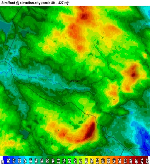
| Scale [m] | 156..353 m | 89..427 m | × |
| Scale [ft] | 512..1158 ft | 292..1401 ft | × |
| Average | 234 m = 768 ft | 232.8 m = 764 ft | × |
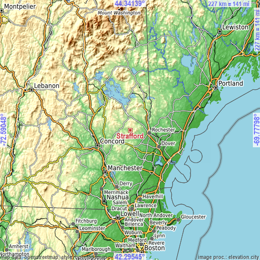
| Width | 7.11 km = 4.4 mi | 14.22 km = 8.8 mi | 227.5 km = 141.4 mi |
| Height | 7.11 km = 4.4 mi | 14.22 km = 8.8 mi | 227.5 km = 141.4 mi |
| ↑Max Latitude | 43.35899° | 43.390932° | 44.34139° |
| Latitude at center | 43.32703° | 43.32703° | 43.32703° |
| ↓Min Latitude | 43.295054° | 43.26306° | 42.29545° |
| ← Min Longitude | -71.228175° | -71.272121° | -72.59048° |
| Longitude center | -71.18423° | -71.18423° | -71.18423° |
| →Max Longitude | -71.140285° | -71.096339° | -69.77798° |
Nearby cities:
Cities around Strafford sort by population:
• Rochester elevation 73 m
17.1 km,  98°
98°
• Barrington 117 m
16 km,  136°
136°
• Epsom 124 m
16.7 km,  225°
225°
• Barnstead 156 m
8.8 km,  275°
275°
• Nottingham 84 m
24.6 km,  163°
163°
• Farmington 87 m
11.9 km,  54°
54°
• Northwood 173 m
15 km,  169°
169°
• Gilmanton 304 m
21.5 km,  300°
300°
• Chichester 166 m
19.5 km,  243°
243°
• New Durham 165 m
12.2 km,  4°
4°
• Pittsfield 150 m
11.6 km,  258°
258°
• Allenstown 104 m
26 km,  223°
223°
Multilingual:
 En español:
Strafford elevación 200 m.
 En France:
Strafford élévation 200 m.
 Auf Deutsch:
Strafford höhe über dem Meeresspiegel ist 200 m.

Sources and notes:
- [note 1] Map square and city borders are not equal. Map elevation data is calculated only from area inside that square.
- [src 1] Elevation data from geonames database provided with same terms of usage.
- [src 2] The elevation map of Strafford is generated using elevation data from NASA's 3 arcsec (90m) resolution SRTM data.
- [src 3] Base (background) map © OpenStreetMap contributors tiles are generated by Geofabrik and OpenTopoMap.
Copyright & License:
This Strafford Elevation Map is licensed under CC BY-SA. You may reuse any part from this page, if you give a proper credit by linking to this URL:
 More info on terms of use page.