Rochester elevation
Rochester (New Hampshire, Strafford County), United States elevation is 73 meters and Rochester elevation in feet is 240 ft above sea level [src 1]. Rochester is a populated place (feature code) with elevation that is 206 meters (676 ft) smaller than average city elevation in United States.
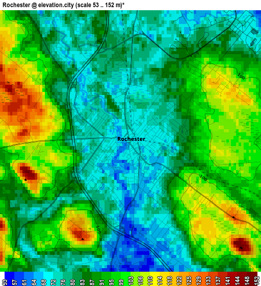
Below is the Elevation map of Rochester, which displays elevation range with different colors. Scale of the first map is from 53 to 152 m (174 to 499 ft) with average elevation of 88.5 meters (=290 ft) [note 1]
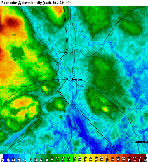
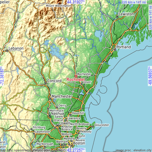
These maps also provides idea of topography and contour of this city, they are displayed at different zoom levels. More info about maps, scale and edge coordinates you can find below images.
| \ | Map #1 | Map #2 | Topo.Map |
| Scale [m] | 53..152 m | 39..224 m | × |
| Scale [ft] | 174..499 ft | 128..735 ft | × |
| Average | 88.5 m = 290 ft | 92.8 m = 304 ft | × |
| Width | 7.11 km = 4.4 mi | 14.22 km = 8.8 mi | 227.6 km = 141.4 mi |
| Height | 7.11 km = 4.4 mi | 14.22 km = 8.8 mi | 227.6 km = 141.4 mi |
| ↑Max Latitude | 43.336501° | 43.368456° | 44.31927° |
| Latitude at center | 43.30453° | 43.30453° | 43.30453° |
| ↓Min Latitude | 43.272542° | 43.240537° | 42.27257° |
| ← Min Longitude | -71.019565° | -71.063511° | -72.38187° |
| Longitude center | -70.97562° | -70.97562° | -70.97562° |
| →Max Longitude | -70.931675° | -70.887729° | -69.56937° |
Nearby cities:
Cities around Rochester sort by population:
• Dover elevation 23 m
14.5 km,  145°
145°
• Somersworth 69 m
10.1 km,  118°
118°
• Durham 17 m
19.4 km,  168°
168°
• Barrington 117 m
10.8 km,  212°
212°
• South Berwick 38 m
15.5 km, 120°
• Lebanon 90 m
14.2 km,  45°
45°
• Farmington 87 m
11.9 km,  322°
322°
• Northwood 173 m
18.8 km,  229°
229°
• Strafford 200 m
17.1 km,  278°
278°
• Rollinsford 32 m
14.7 km, 121°
• Berwick 57 m
10 km, 115°
• Madbury 40 m
15.6 km,  164°
164°
Multilingual:
 En español:
Rochester elevación 73 m.
 En France:
Rochester élévation 73 m.
 Auf Deutsch:
Rochester höhe über dem Meeresspiegel ist 73 m.

Sources and notes:
- [note 1] Map square and city borders are not equal. Map elevation data is calculated only from area inside that square.
- [src 1] Elevation data from geonames database provided with same terms of usage.
- [src 2] The elevation map of Rochester is generated using elevation data from NASA's 3 arcsec (90m) resolution SRTM data.
- [src 3] Base (background) map © OpenStreetMap contributors tiles are generated by Geofabrik and OpenTopoMap.
Copyright & License:
This Rochester Elevation Map is licensed under CC BY-SA. You may reuse any part from this page, if you give a proper credit by linking to this URL:
 More info on terms of use page.