Richmond elevation
Richmond (New Hampshire, Cheshire County), United States elevation is 327 meters and Richmond elevation in feet is 1073 ft above sea level [src 1]. Richmond is a populated place (feature code) with elevation that is 48 meters (157 ft) bigger than average city elevation in United States.
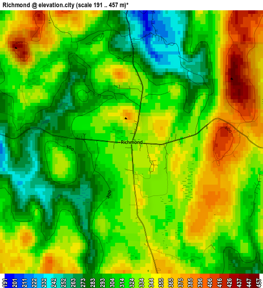
Below is the Elevation map of Richmond, which displays elevation range with different colors. Scale of the first map is from 191 to 457 m (627 to 1499 ft) with average elevation of 323.2 meters (=1060 ft) [note 1]
These maps also provides idea of topography and contour of this city, they are displayed at different zoom levels. More info about maps, scale and edge coordinates you can find below images.
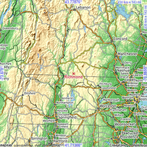
| \ | Map #1 | Topo.Map |
| Scale [m] | 191..457 m | × |
| Scale [ft] | 627..1499 ft | × |
| Average | 323.2 m = 1060 ft | × |
| Width | 7.18 km = 4.5 mi | 229.6 km = 142.7 mi |
| Height | 7.18 km = 4.5 mi | 229.6 km = 142.7 mi |
| ↑Max Latitude | 42.787069° | 43.77876° |
| Latitude at center | 42.75481° | 42.75481° |
| ↓Min Latitude | 42.722534° | 41.71366° |
| ← Min Longitude | -72.315695° | -73.678° |
| Longitude center | -72.27175° | -72.27175° |
| →Max Longitude | -72.227805° | -70.8655° |
Nearby cities:
Cities around Richmond sort by population:
• Keene elevation 150 m
19.9 km,  358°
358°
• Athol 170 m
18 km,  168°
168°
• Swanzey 158 m
12.8 km, 356°
• Orange 158 m
18.5 km,  189°
189°
• Fitzwilliam 351 m
11 km,  74°
74°
• Winchester 135 m
9.3 km,  282°
282°
• Hinsdale 70 m
17.9 km, 281°
• West Swanzey 162 m
13.5 km,  342°
342°
• Royalston 309 m
11 km,  141°
141°
• Troy 311 m
10.7 km,  43°
43°
• Marlborough 222 m
17.4 km,  17°
17°
• Northfield 91 m
16.2 km,  246°
246°
Multilingual:
 En español:
Richmond elevación 327 m.
 En France:
Richmond élévation 327 m.
 Auf Deutsch:
Richmond höhe über dem Meeresspiegel ist 327 m.

Sources and notes:
- [note 1] Map square and city borders are not equal. Map elevation data is calculated only from area inside that square.
- [src 1] Elevation data from geonames database provided with same terms of usage.
- [src 2] The elevation map of Richmond is generated using elevation data from NASA's 3 arcsec (90m) resolution SRTM data.
- [src 3] Base (background) map © OpenStreetMap contributors tiles are generated by Geofabrik and OpenTopoMap.
Copyright & License:
This Richmond Elevation Map is licensed under CC BY-SA. You may reuse any part from this page, if you give a proper credit by linking to this URL:
 More info on terms of use page.