Unionville elevation
Unionville (Missouri, Putnam County), United States elevation is 327 meters and Unionville elevation in feet is 1073 ft above sea level [src 1]. Unionville is a seat of a second-order administrative division (feature code) with elevation that is 48 meters (157 ft) bigger than average city elevation in United States.
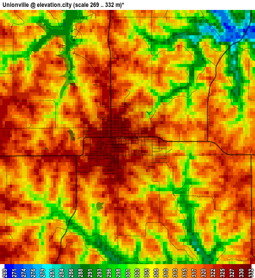
Below is the Elevation map of Unionville, which displays elevation range with different colors. Scale of the first map is from 269 to 332 m (883 to 1089 ft) with average elevation of 312 meters (=1024 ft) [note 1]
These maps also provides idea of topography and contour of this city, they are displayed at different zoom levels. More info about maps, scale and edge coordinates you can find below images.
| \ | Map #1 | Topo.Map |
| Scale [m] | 269..332 m | × |
| Scale [ft] | 883..1089 ft | × |
| Average | 312 m = 1024 ft | × |
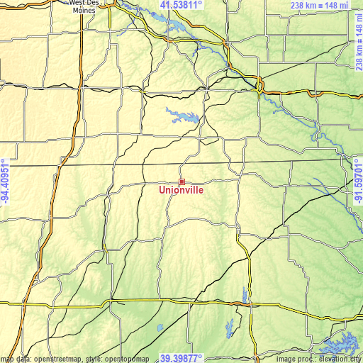
| Width | 7.43 km = 4.6 mi | 237.9 km = 147.8 mi |
| Height | 7.43 km = 4.6 mi | 237.9 km = 147.8 mi |
| ↑Max Latitude | 40.510379° | 41.53811° |
| Latitude at center | 40.47696° | 40.47696° |
| ↓Min Latitude | 40.443524° | 39.39877° |
| ← Min Longitude | -93.047205° | -94.40951° |
| Longitude center | -93.00326° | -93.00326° |
| →Max Longitude | -92.959315° | -91.59701° |
Nearby cities:
Cities around Unionville sort by population:
• Kirksville elevation 302 m
47.5 km,  131°
131°
• Trenton 261 m
68.3 km,  229°
229°
• Centerville 311 m
30.6 km,  20°
20°
• Chariton 315 m
64.9 km,  336°
336°
• Albia 292 m
63.3 km, 15°
• Bloomfield 265 m
58.3 km,  58°
58°
• Terre Haute 318 m
20 km,  257°
257°
• Milan 298 m
32.2 km,  198°
198°
• Corydon 334 m
41 km,  319°
319°
• La Plata 287 m
66.6 km,  139°
139°
• Princeton 296 m
49.6 km, 260°
• Lancaster 291 m
40.5 km,  83°
83°
Multilingual:
 En español:
Unionville elevación 327 m.
 En France:
Unionville élévation 327 m.
 Auf Deutsch:
Unionville höhe über dem Meeresspiegel ist 327 m.

Sources and notes:
- [note 1] Map square and city borders are not equal. Map elevation data is calculated only from area inside that square.
- [src 1] Elevation data from geonames database provided with same terms of usage.
- [src 2] The elevation map of Unionville is generated using elevation data from NASA's 3 arcsec (90m) resolution SRTM data.
- [src 3] Base (background) map © OpenStreetMap contributors tiles are generated by Geofabrik and OpenTopoMap.
Copyright & License:
This Unionville Elevation Map is licensed under CC BY-SA. You may reuse any part from this page, if you give a proper credit by linking to this URL:
 More info on terms of use page.