Kirksville elevation
Kirksville (Missouri, Adair County), United States elevation is 302 meters and Kirksville elevation in feet is 991 ft above sea level [src 1]. Kirksville is a seat of a second-order administrative division (feature code) with elevation that is 23 meters (75 ft) bigger than average city elevation in United States.
Below is the Elevation map of Kirksville, which displays elevation range with different colors. Scale of the first map is from 244 to 306 m (801 to 1004 ft) with average elevation of 290.2 meters (=952 ft) [note 1]
These maps also provides idea of topography and contour of this city, they are displayed at different zoom levels. More info about maps, scale and edge coordinates you can find below images.
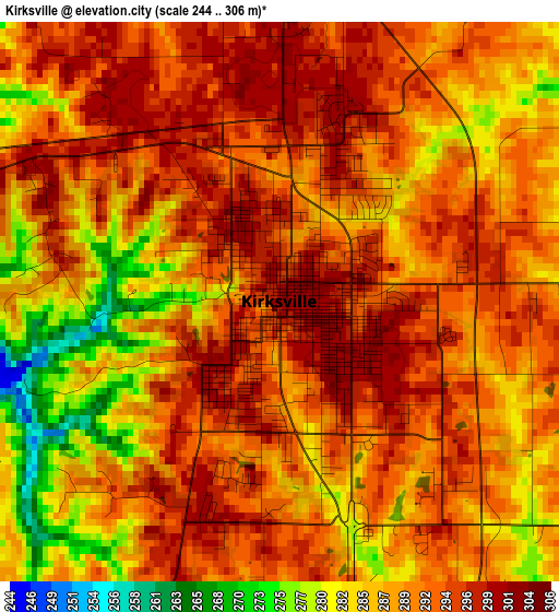
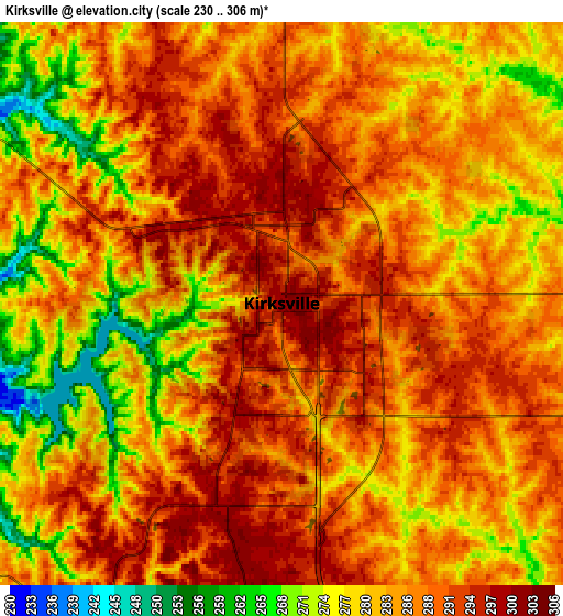
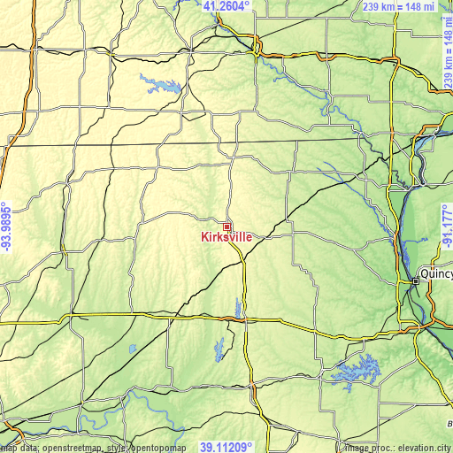
| \ | Map #1 | Map #2 | Topo.Map |
| Scale [m] | 244..306 m | 230..306 m | × |
| Scale [ft] | 801..1004 ft | 755..1004 ft | × |
| Average | 290.2 m = 952 ft | 284.8 m = 934 ft | × |
| Width | 7.46 km = 4.6 mi | 14.93 km = 9.3 mi | 238.9 km = 148.4 mi |
| Height | 7.46 km = 4.6 mi | 14.93 km = 9.3 mi | 238.9 km = 148.4 mi |
| ↑Max Latitude | 40.22831° | 40.261852° | 41.2604° |
| Latitude at center | 40.19475° | 40.19475° | 40.19475° |
| ↓Min Latitude | 40.161174° | 40.127581° | 39.11209° |
| ← Min Longitude | -92.627195° | -92.671141° | -93.9895° |
| Longitude center | -92.58325° | -92.58325° | -92.58325° |
| →Max Longitude | -92.539305° | -92.495359° | -91.177° |
Nearby cities:
Cities around Kirksville sort by population:
• Macon elevation 271 m
51.2 km,  169°
169°
• Brookfield 232 m
61.9 km,  222°
222°
• Terre Haute 318 m
61.5 km,  296°
296°
• Marceline 266 m
62 km,  210°
210°
• Milan 298 m
46 km,  271°
271°
• Memphis 244 m
45.6 km,  50°
50°
• Unionville 327 m
47.5 km,  311°
311°
• La Plata 287 m
20.6 km,  157°
157°
• Edina 249 m
35 km,  94°
94°
• Lancaster 291 m
36.6 km,  7°
7°
• Shelbyville 234 m
63.2 km,  133°
133°
• Linneus 257 m
62.4 km,  235°
235°
Multilingual:
 En español:
Kirksville elevación 302 m.
 En France:
Kirksville élévation 302 m.
 Auf Deutsch:
Kirksville höhe über dem Meeresspiegel ist 302 m.

Sources and notes:
- [note 1] Map square and city borders are not equal. Map elevation data is calculated only from area inside that square.
- [src 1] Elevation data from geonames database provided with same terms of usage.
- [src 2] The elevation map of Kirksville is generated using elevation data from NASA's 3 arcsec (90m) resolution SRTM data.
- [src 3] Base (background) map © OpenStreetMap contributors tiles are generated by Geofabrik and OpenTopoMap.
Copyright & License:
This Kirksville Elevation Map is licensed under CC BY-SA. You may reuse any part from this page, if you give a proper credit by linking to this URL:
 More info on terms of use page.