Marlborough elevation
Marlborough (Massachusetts, Middlesex County), United States elevation is 127 meters and Marlborough elevation in feet is 417 ft above sea level [src 1]. Marlborough is a populated place (feature code) with elevation that is 152 meters (499 ft) smaller than average city elevation in United States.
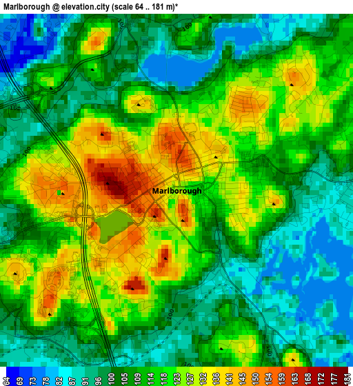
Below is the Elevation map of Marlborough, which displays elevation range with different colors. Scale of the first map is from 64 to 181 m (210 to 594 ft) with average elevation of 111.3 meters (=365 ft) [note 1]
These maps also provides idea of topography and contour of this city, they are displayed at different zoom levels. More info about maps, scale and edge coordinates you can find below images.
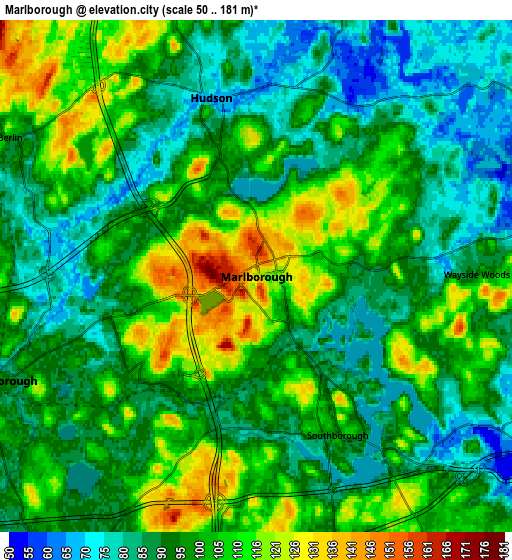
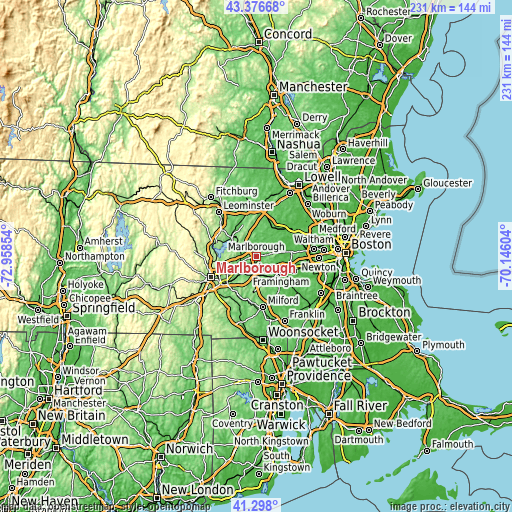
| \ | Map #1 | Map #2 | Topo.Map |
| Scale [m] | 64..181 m | 50..181 m | × |
| Scale [ft] | 210..594 ft | 164..594 ft | × |
| Average | 111.3 m = 365 ft | 97.8 m = 321 ft | × |
| Width | 7.22 km = 4.5 mi | 14.45 km = 9 mi | 231.1 km = 143.6 mi |
| Height | 7.22 km = 4.5 mi | 14.45 km = 9 mi | 231.1 km = 143.6 mi |
| ↑Max Latitude | 42.378401° | 42.410856° | 43.37668° |
| Latitude at center | 42.34593° | 42.34593° | 42.34593° |
| ↓Min Latitude | 42.313442° | 42.280937° | 41.298° |
| ← Min Longitude | -71.596235° | -71.640181° | -72.95854° |
| Longitude center | -71.55229° | -71.55229° | -71.55229° |
| →Max Longitude | -71.508345° | -71.464399° | -70.14604° |
Nearby cities:
Cities around Marlborough sort by population:
• Framingham Center elevation 84 m
10.9 km,  119°
119°
• Sudbury 64 m
11.9 km,  69°
69°
• Ashland 60 m
11.9 km,  142°
142°
• Hudson 67 m
5.2 km,  347°
347°
• Maynard 50 m
12.9 km,  40°
40°
• Southborough 94 m
5 km,  152°
152°
• Northborough 93 m
7.9 km,  248°
248°
• Stow 72 m
10.8 km,  20°
20°
• Bolton 123 m
10.7 km,  334°
334°
• Westborough 96 m
10 km,  211°
211°
• Cordaville 86 m
8.9 km,  164°
164°
• Berlin 99 m
8 km,  299°
299°
Multilingual:
 En español:
Marlborough elevación 127 m.
 En France:
Marlborough élévation 127 m.
 Auf Deutsch:
Marlborough höhe über dem Meeresspiegel ist 127 m.

Sources and notes:
- [note 1] Map square and city borders are not equal. Map elevation data is calculated only from area inside that square.
- [src 1] Elevation data from geonames database provided with same terms of usage.
- [src 2] The elevation map of Marlborough is generated using elevation data from NASA's 3 arcsec (90m) resolution SRTM data.
- [src 3] Base (background) map © OpenStreetMap contributors tiles are generated by Geofabrik and OpenTopoMap.
Copyright & License:
This Marlborough Elevation Map is licensed under CC BY-SA. You may reuse any part from this page, if you give a proper credit by linking to this URL:
 More info on terms of use page.