Framingham Center elevation
Framingham Center (Massachusetts, Middlesex County), United States elevation is 84 meters and Framingham Center elevation in feet is 276 ft above sea level [src 1]. Framingham Center is a populated place (feature code) with elevation that is 195 meters (640 ft) smaller than average city elevation in United States.
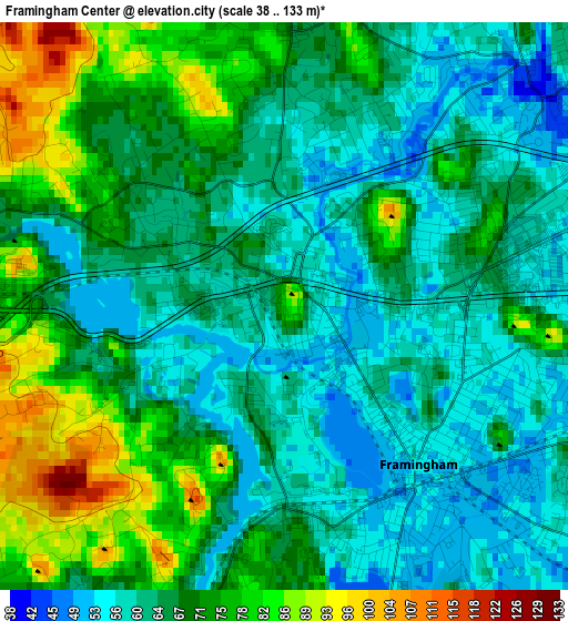
Below is the Elevation map of Framingham Center, which displays elevation range with different colors. Scale of the first map is from 38 to 133 m (125 to 436 ft) with average elevation of 66.8 meters (=219 ft) [note 1]
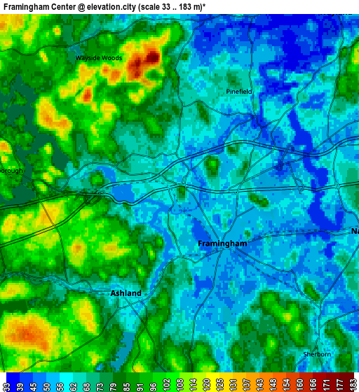
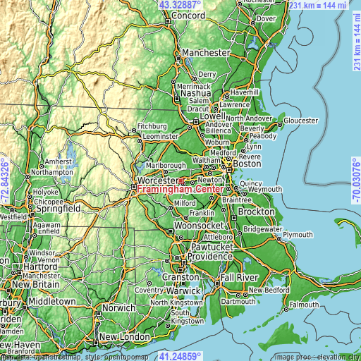
These maps also provides idea of topography and contour of this city, they are displayed at different zoom levels. More info about maps, scale and edge coordinates you can find below images.
| \ | Map #1 | Map #2 | Topo.Map |
| Scale [m] | 38..133 m | 33..183 m | × |
| Scale [ft] | 125..436 ft | 108..600 ft | × |
| Average | 66.8 m = 219 ft | 74.5 m = 244 ft | × |
| Width | 7.23 km = 4.5 mi | 14.46 km = 9 mi | 231.3 km = 143.7 mi |
| Height | 7.23 km = 4.5 mi | 14.46 km = 9 mi | 231.3 km = 143.7 mi |
| ↑Max Latitude | 42.329816° | 42.362296° | 43.32887° |
| Latitude at center | 42.29732° | 42.29732° | 42.29732° |
| ↓Min Latitude | 42.264807° | 42.232277° | 41.24859° |
| ← Min Longitude | -71.480955° | -71.524901° | -72.84326° |
| Longitude center | -71.43701° | -71.43701° | -71.43701° |
| →Max Longitude | -71.393065° | -71.349119° | -70.03076° |
Nearby cities:
Cities around Framingham Center sort by population:
• Framingham elevation 54 m
2.6 km,  139°
139°
• Marlborough 127 m
10.9 km,  299°
299°
• Natick 55 m
7.4 km,  102°
102°
• Sudbury 64 m
9.7 km,  10°
10°
• Ashland 60 m
4.6 km,  208°
208°
• Holliston 62 m
10.9 km,  174°
174°
• Wayland 38 m
9.6 km,  40°
40°
• Southborough 94 m
7.3 km,  277°
277°
• Cochituate 55 m
6.5 km,  66°
66°
• Sherborn 70 m
8.5 km, 139°
• Cordaville 86 m
7.8 km,  246°
246°
• Hopkinton 135 m
10.4 km,  222°
222°
Multilingual:
 En español:
Framingham Center elevación 84 m.
 En France:
Framingham Center élévation 84 m.
 Auf Deutsch:
Framingham Center höhe über dem Meeresspiegel ist 84 m.

Sources and notes:
- [note 1] Map square and city borders are not equal. Map elevation data is calculated only from area inside that square.
- [src 1] Elevation data from geonames database provided with same terms of usage.
- [src 2] The elevation map of Framingham Center is generated using elevation data from NASA's 3 arcsec (90m) resolution SRTM data.
- [src 3] Base (background) map © OpenStreetMap contributors tiles are generated by Geofabrik and OpenTopoMap.
Copyright & License:
This Framingham Center Elevation Map is licensed under CC BY-SA. You may reuse any part from this page, if you give a proper credit by linking to this URL:
 More info on terms of use page.