Angola elevation
Angola (Indiana, Steuben County), United States elevation is 324 meters and Angola elevation in feet is 1063 ft above sea level [src 1]. Angola is a seat of a second-order administrative division (feature code) with elevation that is 45 meters (148 ft) bigger than average city elevation in United States.
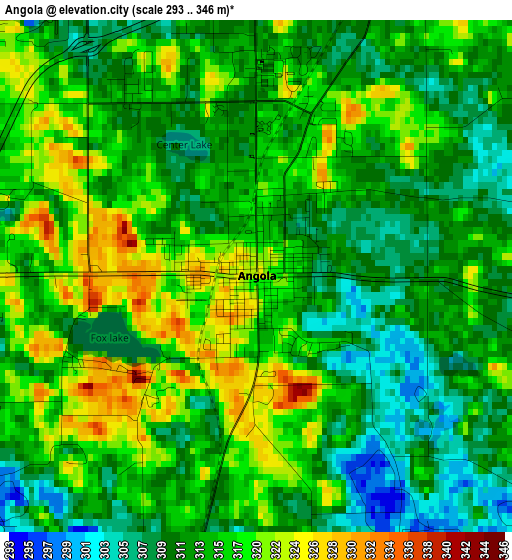
Below is the Elevation map of Angola, which displays elevation range with different colors. Scale of the first map is from 293 to 346 m (961 to 1135 ft) with average elevation of 314.5 meters (=1032 ft) [note 1]
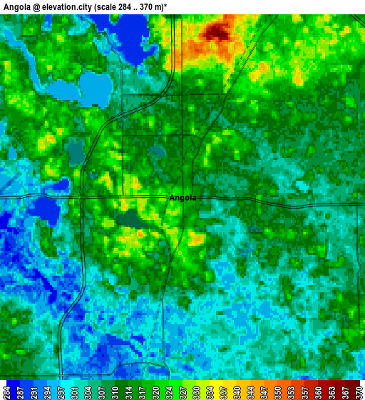
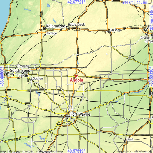
These maps also provides idea of topography and contour of this city, they are displayed at different zoom levels. More info about maps, scale and edge coordinates you can find below images.
| \ | Map #1 | Map #2 | Topo.Map |
| Scale [m] | 293..346 m | 284..370 m | × |
| Scale [ft] | 961..1135 ft | 932..1214 ft | × |
| Average | 314.5 m = 1032 ft | 310 m = 1017 ft | × |
| Width | 7.3 km = 4.5 mi | 14.61 km = 9.1 mi | 233.7 km = 145.2 mi |
| Height | 7.3 km = 4.5 mi | 14.61 km = 9.1 mi | 233.7 km = 145.2 mi |
| ↑Max Latitude | 41.667606° | 41.700426° | 42.67721° |
| Latitude at center | 41.63477° | 41.63477° | 41.63477° |
| ↓Min Latitude | 41.601917° | 41.569048° | 40.57519° |
| ← Min Longitude | -85.043355° | -85.087301° | -86.40566° |
| Longitude center | -84.99941° | -84.99941° | -84.99941° |
| →Max Longitude | -84.955465° | -84.911519° | -83.59316° |
Nearby cities:
Cities around Angola sort by population:
• Auburn elevation 267 m
30.2 km,  189°
189°
• Kendallville 302 m
30.8 km,  225°
225°
• Garrett 272 m
33.7 km,  199°
199°
• Montpelier 266 m
33.2 km,  99°
99°
• Butler 266 m
25.2 km,  154°
154°
• Bronson 281 m
31 km,  328°
328°
• Waterloo 278 m
22.6 km,  184°
184°
• Fremont 321 m
12 km,  27°
27°
• Edgerton 259 m
29.4 km,  134°
134°
• Hamilton 276 m
13.4 km, 147°
• Reading 366 m
30.9 km,  42°
42°
• Wolcottville 284 m
32.9 km,  248°
248°
Multilingual:
 En español:
Angola elevación 324 m.
 En France:
Angola élévation 324 m.


Sources and notes:
- [note 1] Map square and city borders are not equal. Map elevation data is calculated only from area inside that square.
- [src 1] Elevation data from geonames database provided with same terms of usage.
- [src 2] The elevation map of Angola is generated using elevation data from NASA's 3 arcsec (90m) resolution SRTM data.
- [src 3] Base (background) map © OpenStreetMap contributors tiles are generated by Geofabrik and OpenTopoMap.
Copyright & License:
This Angola Elevation Map is licensed under CC BY-SA. You may reuse any part from this page, if you give a proper credit by linking to this URL:
 More info on terms of use page.