Garrett elevation
Garrett (Indiana, DeKalb County), United States elevation is 272 meters and Garrett elevation in feet is 892 ft above sea level [src 1]. Garrett is a populated place (feature code) with elevation that is 7 meters (23 ft) smaller than average city elevation in United States.
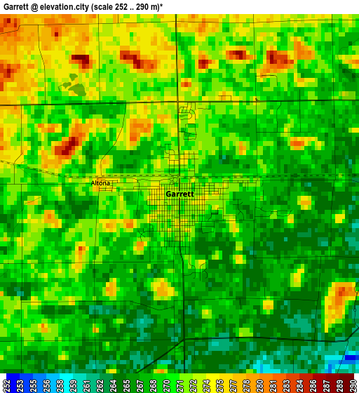
Below is the Elevation map of Garrett, which displays elevation range with different colors. Scale of the first map is from 252 to 290 m (827 to 951 ft) with average elevation of 269.7 meters (=885 ft) [note 1]
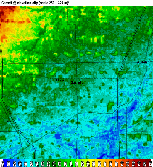
These maps also provides idea of topography and contour of this city, they are displayed at different zoom levels. More info about maps, scale and edge coordinates you can find below images.
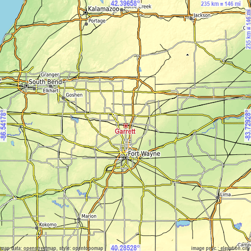
| \ | Map #1 | Map #2 | Topo.Map |
| Scale [m] | 252..290 m | 250..324 m | × |
| Scale [ft] | 827..951 ft | 820..1063 ft | × |
| Average | 269.7 m = 885 ft | 272 m = 892 ft | × |
| Width | 7.34 km = 4.6 mi | 14.67 km = 9.1 mi | 234.8 km = 145.9 mi |
| Height | 7.34 km = 4.6 mi | 14.67 km = 9.1 mi | 234.7 km = 145.8 mi |
| ↑Max Latitude | 41.382471° | 41.415436° | 42.39658° |
| Latitude at center | 41.34949° | 41.34949° | 41.34949° |
| ↓Min Latitude | 41.316492° | 41.283478° | 40.28528° |
| ← Min Longitude | -85.179475° | -85.223421° | -86.54178° |
| Longitude center | -85.13553° | -85.13553° | -85.13553° |
| →Max Longitude | -85.091585° | -85.047639° | -83.72928° |
Nearby cities:
Cities around Garrett sort by population:
• Fort Wayne elevation 250 m
24.3 km,  178°
178°
• Auburn 267 m
6.7 km,  73°
73°
• Kendallville 302 m
14.9 km,  313°
313°
• Huntertown 260 m
13.8 km,  192°
192°
• Leo-Cedarville 246 m
18.2 km,  146°
146°
• Butler 266 m
23.8 km, 67°
• Avilla 295 m
8.8 km,  281°
281°
• Albion 293 m
24.6 km, 282°
• Waterloo 278 m
13.3 km,  46°
46°
• Churubusco 273 m
20.3 km,  229°
229°
• Harlan 241 m
24.8 km,  133°
133°
• Grabill 251 m
20.9 km,  137°
137°
Multilingual:
 En español:
Garrett elevación 272 m.
 En France:
Garrett élévation 272 m.


Sources and notes:
- [note 1] Map square and city borders are not equal. Map elevation data is calculated only from area inside that square.
- [src 1] Elevation data from geonames database provided with same terms of usage.
- [src 2] The elevation map of Garrett is generated using elevation data from NASA's 3 arcsec (90m) resolution SRTM data.
- [src 3] Base (background) map © OpenStreetMap contributors tiles are generated by Geofabrik and OpenTopoMap.
Copyright & License:
This Garrett Elevation Map is licensed under CC BY-SA. You may reuse any part from this page, if you give a proper credit by linking to this URL:
 More info on terms of use page.