Mendota elevation
Mendota (Illinois, LaSalle County), United States elevation is 229 meters and Mendota elevation in feet is 751 ft above sea level [src 1]. Mendota is a populated place (feature code) with elevation that is 50 meters (164 ft) smaller than average city elevation in United States.
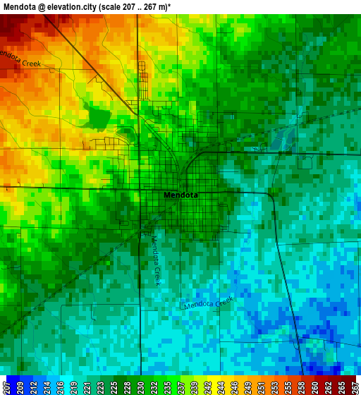
Below is the Elevation map of Mendota, which displays elevation range with different colors. Scale of the first map is from 207 to 267 m (679 to 876 ft) with average elevation of 228.8 meters (=751 ft) [note 1]
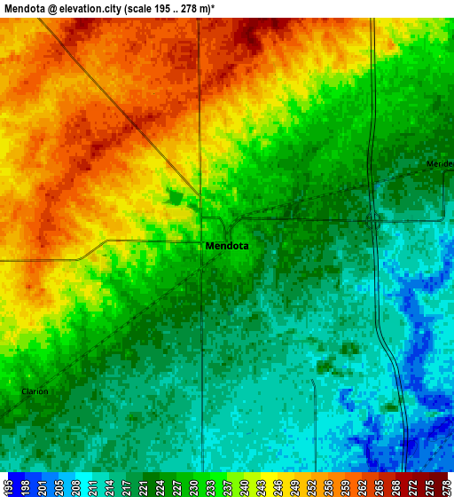
These maps also provides idea of topography and contour of this city, they are displayed at different zoom levels. More info about maps, scale and edge coordinates you can find below images.
| \ | Map #1 | Map #2 | Topo.Map |
| Scale [m] | 207..267 m | 195..278 m | × |
| Scale [ft] | 679..876 ft | 640..912 ft | × |
| Average | 228.8 m = 751 ft | 231.3 m = 759 ft | × |
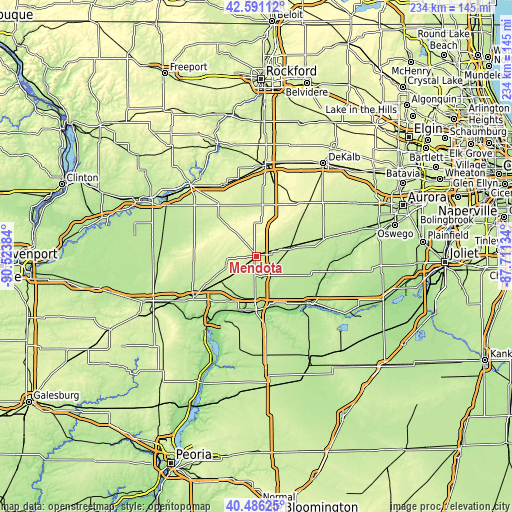
| Width | 7.31 km = 4.5 mi | 14.63 km = 9.1 mi | 234 km = 145.4 mi |
| Height | 7.31 km = 4.5 mi | 14.63 km = 9.1 mi | 234 km = 145.4 mi |
| ↑Max Latitude | 41.580131° | 41.612995° | 42.59112° |
| Latitude at center | 41.54725° | 41.54725° | 41.54725° |
| ↓Min Latitude | 41.514353° | 41.481438° | 40.48625° |
| ← Min Longitude | -89.161535° | -89.205481° | -90.52384° |
| Longitude center | -89.11759° | -89.11759° | -89.11759° |
| →Max Longitude | -89.073645° | -89.029699° | -87.71134° |
Nearby cities:
Cities around Mendota sort by population:
• Ottawa elevation 150 m
32.1 km,  134°
134°
• Peru 185 m
24.4 km,  182°
182°
• La Salle 175 m
23.9 km,  174°
174°
• Princeton 219 m
35.1 km,  235°
235°
• Spring Valley 183 m
25.4 km,  195°
195°
• Oglesby 194 m
28.4 km, 170°
• Deer Park 177 m
28.9 km, 166°
• Amboy 230 m
25.5 km,  316°
316°
• Depue 145 m
29.4 km,  212°
212°
• Earlville 215 m
16.9 km,  73°
73°
• Granville 211 m
33.1 km, 196°
• Ladd 200 m
20.2 km, 204°
Multilingual:
 En español:
Mendota elevación 229 m.
 En France:
Mendota élévation 229 m.


Sources and notes:
- [note 1] Map square and city borders are not equal. Map elevation data is calculated only from area inside that square.
- [src 1] Elevation data from geonames database provided with same terms of usage.
- [src 2] The elevation map of Mendota is generated using elevation data from NASA's 3 arcsec (90m) resolution SRTM data.
- [src 3] Base (background) map © OpenStreetMap contributors tiles are generated by Geofabrik and OpenTopoMap.
Copyright & License:
This Mendota Elevation Map is licensed under CC BY-SA. You may reuse any part from this page, if you give a proper credit by linking to this URL:
 More info on terms of use page.