Ottawa elevation
Ottawa (Illinois, LaSalle County), United States elevation is 150 meters and Ottawa elevation in feet is 492 ft above sea level [src 1]. Ottawa is a seat of a second-order administrative division (feature code) with elevation that is 129 meters (423 ft) smaller than average city elevation in United States.
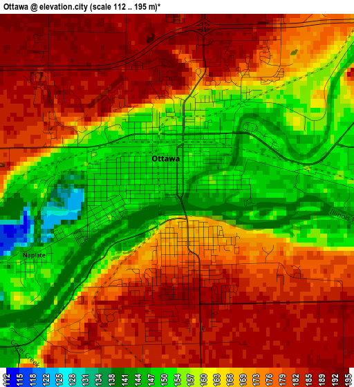
Below is the Elevation map of Ottawa, which displays elevation range with different colors. Scale of the first map is from 112 to 195 m (367 to 640 ft) with average elevation of 167.7 meters (=550 ft) [note 1]
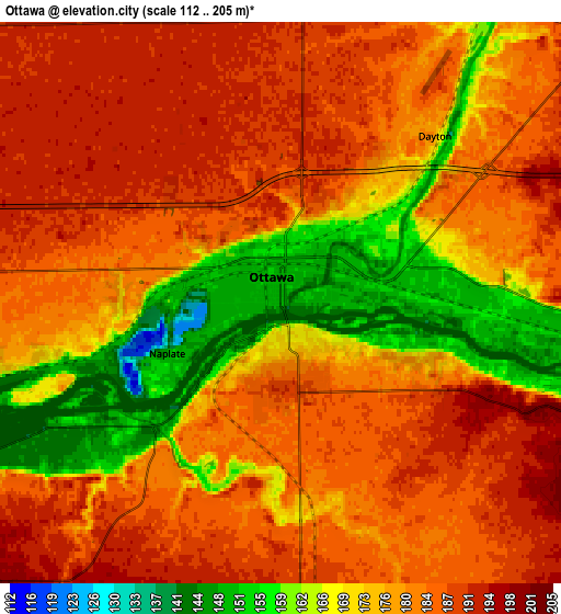
These maps also provides idea of topography and contour of this city, they are displayed at different zoom levels. More info about maps, scale and edge coordinates you can find below images.
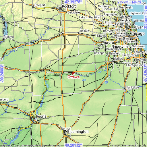
| \ | Map #1 | Map #2 | Topo.Map |
| Scale [m] | 112..195 m | 112..205 m | × |
| Scale [ft] | 367..640 ft | 367..673 ft | × |
| Average | 167.7 m = 550 ft | 178.3 m = 585 ft | × |
| Width | 7.34 km = 4.6 mi | 14.67 km = 9.1 mi | 234.8 km = 145.9 mi |
| Height | 7.34 km = 4.6 mi | 14.67 km = 9.1 mi | 234.8 km = 145.9 mi |
| ↑Max Latitude | 41.378573° | 41.411539° | 42.39275° |
| Latitude at center | 41.34559° | 41.34559° | 41.34559° |
| ↓Min Latitude | 41.31259° | 41.279574° | 40.28132° |
| ← Min Longitude | -88.886525° | -88.930471° | -90.24883° |
| Longitude center | -88.84258° | -88.84258° | -88.84258° |
| →Max Longitude | -88.798635° | -88.754689° | -87.43633° |
Nearby cities:
Cities around Ottawa sort by population:
• Streator elevation 192 m
25 km,  178°
178°
• Peru 185 m
24 km,  265°
265°
• La Salle 175 m
20.8 km, 266°
• Spring Valley 183 m
29.9 km, 266°
• Marseilles 161 m
11.3 km,  98°
98°
• Oglesby 194 m
19 km,  252°
252°
• Deer Park 177 m
17.1 km, 250°
• Sheridan 182 m
24.6 km,  33°
33°
• Seneca 157 m
19.8 km, 101°
• Earlville 215 m
27.9 km,  346°
346°
• Ladd 200 m
31.7 km,  277°
277°
• Newark 207 m
30.3 km,  45°
45°
Multilingual:
 En español:
Ottawa elevación 150 m.
 En France:
Ottawa élévation 150 m.


Sources and notes:
- [note 1] Map square and city borders are not equal. Map elevation data is calculated only from area inside that square.
- [src 1] Elevation data from geonames database provided with same terms of usage.
- [src 2] The elevation map of Ottawa is generated using elevation data from NASA's 3 arcsec (90m) resolution SRTM data.
- [src 3] Base (background) map © OpenStreetMap contributors tiles are generated by Geofabrik and OpenTopoMap.
Copyright & License:
This Ottawa Elevation Map is licensed under CC BY-SA. You may reuse any part from this page, if you give a proper credit by linking to this URL:
 More info on terms of use page.