Pella elevation
Pella (Iowa, Marion County), United States elevation is 273 meters and Pella elevation in feet is 896 ft above sea level [src 1]. Pella is a populated place (feature code) with elevation that is 6 meters (20 ft) smaller than average city elevation in United States.
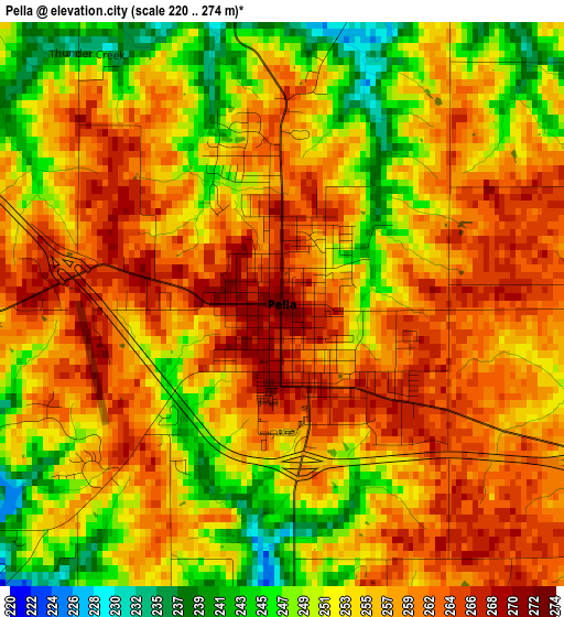
Below is the Elevation map of Pella, which displays elevation range with different colors. Scale of the first map is from 220 to 274 m (722 to 899 ft) with average elevation of 255.7 meters (=839 ft) [note 1]
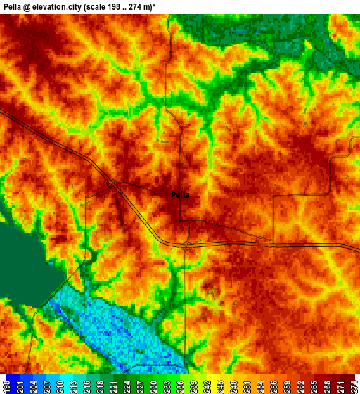
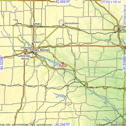
These maps also provides idea of topography and contour of this city, they are displayed at different zoom levels. More info about maps, scale and edge coordinates you can find below images.
| \ | Map #1 | Map #2 | Topo.Map |
| Scale [m] | 220..274 m | 198..274 m | × |
| Scale [ft] | 722..899 ft | 650..899 ft | × |
| Average | 255.7 m = 839 ft | 248.7 m = 816 ft | × |
| Width | 7.33 km = 4.6 mi | 14.66 km = 9.1 mi | 234.5 km = 145.7 mi |
| Height | 7.33 km = 4.6 mi | 14.66 km = 9.1 mi | 234.5 km = 145.7 mi |
| ↑Max Latitude | 41.441001° | 41.473936° | 42.45419° |
| Latitude at center | 41.40805° | 41.40805° | 41.40805° |
| ↓Min Latitude | 41.375082° | 41.342097° | 40.34479° |
| ← Min Longitude | -92.960255° | -93.004201° | -94.32256° |
| Longitude center | -92.91631° | -92.91631° | -92.91631° |
| →Max Longitude | -92.872365° | -92.828419° | -91.51006° |
Nearby cities:
Cities around Pella sort by population:
• Newton elevation 290 m
34.2 km,  341°
341°
• Oskaloosa 256 m
25.9 km,  118°
118°
• Grinnell 309 m
40.6 km,  23°
23°
• Knoxville 276 m
18.8 km,  238°
238°
• Colfax 245 m
40.6 km,  317°
317°
• Monroe 280 m
20 km,  309°
309°
• Prairie City 279 m
34 km, 308°
• Pleasantville 274 m
29.6 km,  265°
265°
• Montezuma 290 m
37.9 km,  58°
58°
• New Sharon 269 m
23.1 km,  72°
72°
• Melcher-Dallas 286 m
33.9 km,  233°
233°
• Eddyville 204 m
36.4 km,  140°
140°
Multilingual:
 En español:
Pella elevación 273 m.
 En France:
Pella élévation 273 m.


Sources and notes:
- [note 1] Map square and city borders are not equal. Map elevation data is calculated only from area inside that square.
- [src 1] Elevation data from geonames database provided with same terms of usage.
- [src 2] The elevation map of Pella is generated using elevation data from NASA's 3 arcsec (90m) resolution SRTM data.
- [src 3] Base (background) map © OpenStreetMap contributors tiles are generated by Geofabrik and OpenTopoMap.
Copyright & License:
This Pella Elevation Map is licensed under CC BY-SA. You may reuse any part from this page, if you give a proper credit by linking to this URL:
 More info on terms of use page.